Feeds:
Posts
Comments

Posts Tagged ‘maps’

Whistle, as an installation, looks to celebrate the engineering heritage of the North of England, but also looks at who we are in the North and the sense of place.

The Great Exhibition of the North could have been anywhere north of Cheshire (I know, don’t get me started on basic geography). However, it’s ended up in Gateshead and Newcastle, so I wanted to see what defines the place in order to start a conversation about its future trajectory. Where does it come from?
town wall map 3

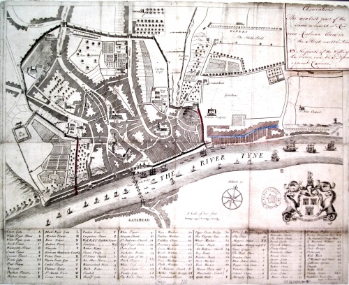
An early 18th century map of Newcastle clearly showing the route of the wall

The Town Wall was built around Newcastle around the 12th Century – primarily to defend it from raiding parties from across the Scottish Border. It was typically 24 ft high (8m) and seven feet (2.5m) thick. There were six main gates – including Westgate and Newgate – and 17 towers – of which parts of six still remain. At its prime it was considered the most impressive town or city wall in the whole of England and was only breached once – by the Scots during the English Civil War. Although over the centuries it fell into disrepair, most of the wall survived into the late 19th Century and there are photographs of most of the towers before the late Victorian redevelopment of the city centre. It’s important to note that Newcastle never had a City wall – it didn’t become a city until the 1890s, by which time most of the wall was in ruins.

Although the wall is by no means complete now, there are surprisingly large amounts still standing, and even in the absent sections its route still survives.
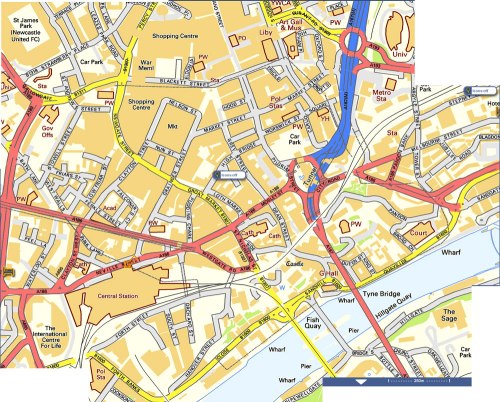
wall-map-web

The current online map on Street Map shows the route of the wall as a dotted line

The challenge for the installation was to find sufficient sites around the wall to place whistles. As they are powered by cylinders of compressed air, the sites had to be secure. At around 130dB they are also very loud, so they had to be well away from ear-level or a safe distance away from the public. The simplest place to put them was on the roof of buildings. That meant finding and securing premises with flat roofs and good access. With a target of 18 venues across an entire city this was far from straight forward. Besides the medieval structures of the actual wall, most of the other buildings along the line of the wall were part of its subsequent history with their own architectural interest. Newcastle is a city rich in history and architectural heritage. Outside of London it has the highest number of historical buildings in England. Newcastle has 53 grade I listed buildings, 153 grade two-star, 558 grade two, 42 scheduled ancient monuments and 12 conservation areas. This in turn created its own set of issues and logistics in terms of getting permissions. In the end 17 locations were identified, which in turn held their own connection to the town wall and the history of the city:
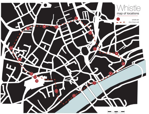
whistle-master-mapv3-web

1: Newcastle City Library – New Bridge Street West.

This was a relatively easy starting point for me as I had untaken a short residency there last year and had a good relationship with the team there. I’d already been up on the roof so I knew it was a great place to host a whistle.
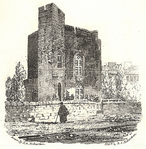
003773:Carliol Tower Newcastle upon Tyne Richardson T.M.  1820?

A drawing from 1825 of Carliol Tower – then a private house
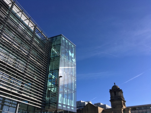
IMG_4221

The 2009 City Library building. Note the angled entrance atrium set at the same angle as the original tower (above)

The current city library was completed in 2009 and was the third library building on the site. The previous one designed by Sir Basil Spence – architect of Coventry Cathedral and Trawsfyndd power station amongst many others – was part of T Dan Smith’s vision for Newcastle’s ‘City in the Sky’ network of elevated walkways. However, by the millennium it was deemed too dark and oppressive and no longer fit for purpose and demolished in 2007. The new library was built to be future proofed as the role of libraries evolved. Built on the site of Carliol Tower on the north-east corner of the town wall, the new facade of the library echoes the idea of a tower and is orientated to match the original 12th century tower. There are some stones from the town wall recovered during the works on display inside.

2: Euro Hostel  – Carliol Square.

The next tower along the wall from the library – Plummer Tower – still exists. Originally known as Carliol Croft Tower, it was home to the guild of Cutlers, then to the Guild of Masons in the 18th Century who subsequently enlarged the building to the street to how it is today. It’s now home to a team of architects who specialise in historic buildings.
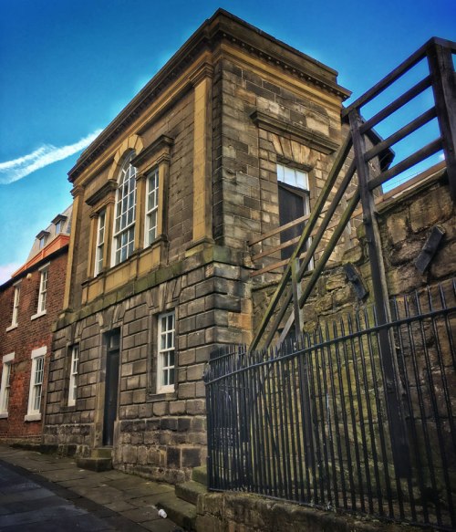
IMG_7730

Plummer Tower

IMG_8810

The view back to the library from the Euro Hostel Roof

Unfortunately the tower has a pitched roof behind the front parapet and with no easy access up there it couldn’t be easily used for hosting a whistle. Instead, the whistle is on top of the Euro Hostel opposite. This has a clear line of sight to the whistle on the library, but also has its own town wall history. The Hostel sits on the site of the town prison. Closed in 1928, you can still see the old execution chamber out the back. ‘The Ware Rooms’ bar is named after the place where one of its former inmates hid his stash of stolen jewellery.

3: Holy Jesus Hospital – City Road

The motorway slices unceremoniously through the line of the wall, with the mainline railway intersecting it from the opposite direction removing all traces of the wall itself. The next tower along the line – Austin Tower – probably lies somewhere beneath Manors Car Park.
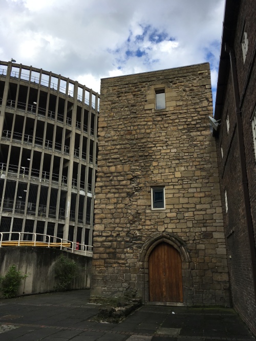
IMG_4324 2

Austin Friary Tower. The part to the right of the door is original and contemporary with the Town Wall. To the left is the wonderful helix ramp on Manors Car Park. The original Austin Tower lies beneath the car park somewhere.

The next nearest spot is Austin Friar’s Tower. Austin Friary was home to a group of Augustinian monks from the 13th Century. The 14th Century tower is all that remains of the friary, although it is now attached to Holy Jesus Hospital – a 17th century building used to offer lodgings – hospitality – to freemen of the city. This is now one of the oldest brick-built buildings still in use. The tower was altered in the 16th century after the dissolution of the monasteries, and became a strong room to protect valuables in the event of the town wall being breached.

The Whistle was to have been installed on the roof of the tower – now in the hands of the National Trust – however, the access costs and logistics were escalating rapidly so this one had to be postponed at a late stage.

4: Sallyport Tower – Tower Street

This building straddles the meeting point of the town wall and Hadrian’s wall. Built on the base of a roman tower, this is the oldest site on the wall. The gate gets its name from being the route the army would rush out to engage with any attacking party – where they would ‘sally forth’. The tower was mostly destroyed in the siege of 1644 – the only time the wall was breached. The building was restored in 1716 with an extension on the top by the Guild of Shipwrights and Carpenters who used it as a meeting room.
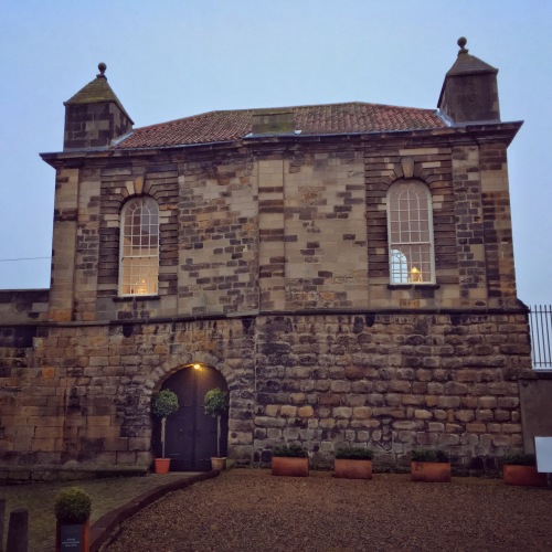
File 24-01-2018, 12 13 41

Sallyport Tower. The foundations are Roman, the ground floor is mostly the original wall. The upper storey is a 17th century addition

The building is currently being run as a wedding venue so the whistle isn’t permanent here.

5: The Jolly Fisherman on the Quayside – Milk Market

From Sallyport Tower, the wall curved gently down to the river. There was no wall as such built along the quayside with the river itself forming the main defence.
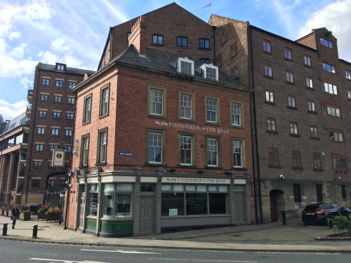
IMG_4307 2

The Tyne Inn pub on the corner of Milk Market. Note the use of stone on the next door building following the line of the Town Wall

The pub most recently known as ‘the Jolly Fisherman’ or the ‘Waterline’ or even the ‘Tyne Inn’ is a grade II listed building built as a pub in 1904. This sat on the corner of the Milk Market and was once part of the busy quayside activity. The ground floor of the building along Milk Market reflects the line of the wall that ran down to the river along this point.

The pub is now part of the ‘Tomahawk’ restaurant on the Quayside. The whistle here sits on top of the hanging sign bracket.

6: Live Buildings – 55 Quayside

This relatively new building is one of the few sites without historical precedent. Sandwiched between a 19th Century quayside inn and the 18th century customs house, in never the less has an unparalleled view of the river and directly opposite the Sage building. From the balcony you also see the rooftops of the neighbouring buildings with a clear view of the bell on the roof of the Customs house next door. A reminder of a time when sound played a bigger role in signalling and communication across the city.
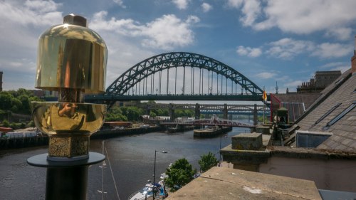
L1140038

Probably the best view from the Quayside. Next door is the Customs House, complete with bell on the roof

The building is now home to Zerolight – one of the ever-growing number of tech and software companies in the city. Here they develop virtual and augmented reality technologies for the luxury car market.

7: Guildhall, Sandhill

The original plan was to site a couple of whistles on the towers of the Tyne Bridge – it being an unmistakable icon of the city. However, every summer the bridge and surrounding buildings become nesting sites for rare kittiwakes. These small sea birds normally nest on cliffs above the sea, but since the 1950s this has become one of only two inland nesting sites for the birds in the world. So the Tye Bridge and many other sites along the quayside cannot be used or accessed during the breeding season.
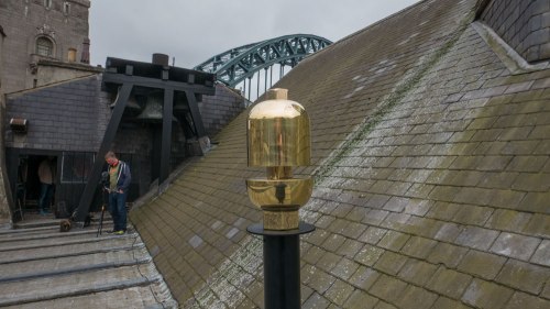
L1140055

The whistle installed on the roof of the Guildhall. The original bells can clearly be seen on the far end

The Guildhall beneath the Tyne Bridge is one of the frequently used nesting sites. However Kittiwakes are fussy birds and only nest where they can see water. So the side facing away from the river is free from nesting birds.

The Guildhall is a Grade I listed building dating from 1665. Built as the seat of local power it was home to the various Guilds who had their individual meeting rooms at each of the castle towers. It was the town hall until the end of the 19th Century when the town became a city. It’s been redesigned and extended at several points over the centuries – the curved east end was designed for the fish market by notable local architect and town planner John Dobson. On the roof is a cupola with a chiming clock. However, below the clock on the north side is an earlier set of bells with the chiming mechanism within the central roof. More reminders of the use of sound within the cityscape.

8: Quayside Inn, 35 Close

This is the last surviving of the original quayside warehouses. From the 16th century this part of the riverside was a maze of narrow streets and houses with numerous warehouses lining the quayside beneath where the High Level Bridge is today. Both sides of the river were busy with ships being loaded and unloaded.

On the 6th October 1854, a fire broke out at Wilson’s worsted mill on the Gateshead side of the river. This rapidly spread to a nearby chemical works which subsequently exploded. Stones were shot hundreds of metres across the river. The force of the blast destroyed the riverside buildings in Gateshead and ripped off the roofs and blew in the shop fronts on Newcastle’s quayside. Burning debris quickly spread through the densely packed buildings along the quayside on the Newcastle side and before long the twin fires decimated both cities. The fire could be watched from the newly opened High Level Bridge.
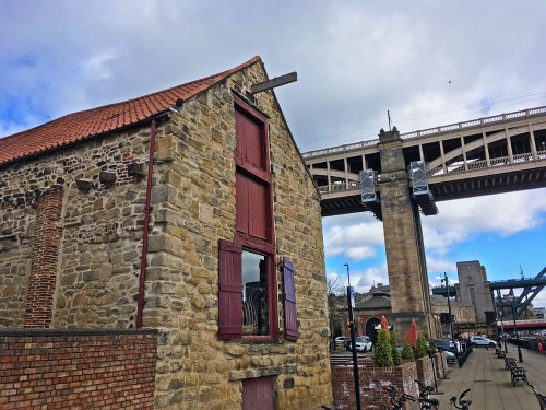
IMG_8147

35 Close sitting beneath Stephenson’s High Level Bridge.

What is now the Quayside Inn is the only building with a riverside frontage to survive. This is now a Grade II* listed building. The whistle is on the outside of the loft doors overlooking the river. This building would have been right on the edge of the river. The quayside has since been infilled so it sits nearly 10 metres in.

9: The Town Wall, Orchard Street

This is one of two lengths of intact town wall remaining. About 80 metres of the wall, most of it the full eight metres high, run along Orchard Street from Forth Street. A fruit orchard grew along this stretch of wall – hence the name. In the 19th century a works building was built into the west side of the wall where you can still see the post holes for the rafters.

IMG_8165

The wall along Orchard Street

A whistle was planned to sit in top of the wall along the walkway. However, access costs started to escalate so this site had to be dropped late on.

10: Central Station main concourse

From Orchard street the wall took a straight line across where the railway now stands before curving round through what is now the main station . With commanding views both to the west and south over the river valley there were three towers within the footprint of the station: Neville Tower stood at the far east end of the platforms and was the meeting hall for ‘the company of Wallers Bricklayers and Plaisterers’. West Spital Tower stood more or less on the concourse and got its name from the nearby St Mary’s Hospital. Stank Tower was on the corner of the entrance portico.
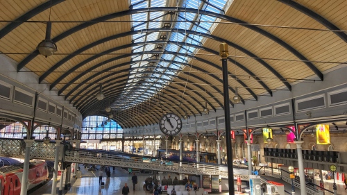
Snapseed 11

The elegantly sweeping curve of Central Station’s roof

Central Station sits on an elegant sweeping curve, accentuated by the vast ironwork roof. The original station building was designed by John Dobson and featured the first great train shed roof, built the same year as the William Paxton Great Exhibition Palace and so considered the cutting edge of architecture of the time. John Dobson won a medal in Paris in 1858 for inventing the rollers used to create the curved girders. The station was officially opened by Queen Victoria and Prince Albert in 1850 when it was mostly just a roof and some facades. The main station buildings weren’t finished in time! Their crests can be seen in the roof trusses.

11. Central Station entrance portico

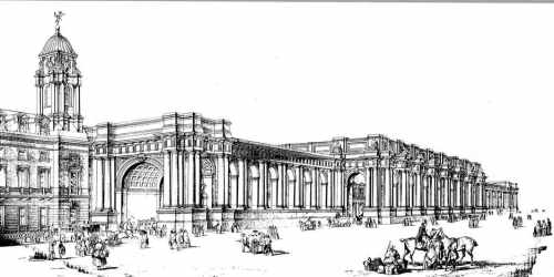
Stank Tower sat on the outside corner of the entrance portico – just beyond the Cafe Nero kiosk. The original plan for the portico was for it to run the entire length of the station . the arches becoming alcoves each with its own statue. However, the scale and associated cost was revisited and a simpler portico was built as survives today.
Newcastle-Central

The original plan was for a portico running the entire length of the station

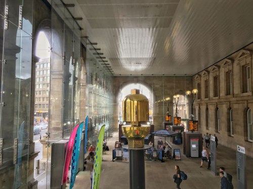
Central Station’s John Dobson lineage and importance in the development of the railway station has earned it a Grade I listing. The connection between the railway engineering aspects of ‘Whistle’ and its location are undoubtedly strongest at the station. By having two whistles within the station  – both indoors and in close proximity, the station is also by far the loudest and most obvious location. The dissonance between the whistles and the lively acoustic make it quite an experience on its own.
Snapseed-14

Whistle in a much more modestly sized entrance portico

12. Gunner House

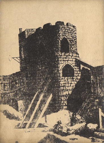
From Stank Tower the wall crossed Neville street diagonally and continued along that line up Pink Lane. Gunner House takes its name from Gunner Tower which stood on the site. You can see the base of the original tower outside the Town Wall pub next door (which also serves a very drinkable   and exclusive ‘Toon Waal’ beer). Gunner Tower became the meeting room for the ‘incorporated company of Slaters and Tylers’. The wall along Pink Lane was removed by the 19th Century.
015014:Gunner Tower Newcastle upon Tyne

A drawing from around 1825 showing Gunner Tower as it remained then. The current Gunner House sits next door and is home to a Subway sandwich shop

14. Heber Tower

I know – there’s no number 13. Certainly unlucky for some – the site of whistle no.13 was never granted permission so was cancelled quite early on.

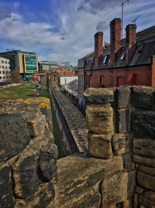
No. 14 however is on the wall itself. Heber Tower sits at the corner of the most complete section of wall still standing. West walls runs from Durham Tower, past Heber Tower, Morden Tower and ending with the remains of Ever Tower. Like Durham Tower, Heber Tower survives almost intact as when it was first built in the 13th century. Access to the walkway is via one of two internal staircases. Along the top of the wall you can clearly see the walkway and how it went through the intermediate sentry towers. From the 15th century the tower became the meeting place and was maintained by the Guild of Felt-makers, Curriers, and Armourers. In the 19th century the tower was used by a blacksmiths.
Snapseed 17.jpg

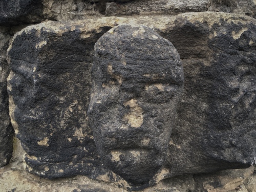
View along the top of the wall from Heber Tower looking towards Merton Tower. The Fosse – or Town Ditch – can just be seen on the left. In the foreground is one of the 13th century carved heads

The top of the tower overlooks the last remnant of the ditch that ran the length of the wall as part of the town defences. The parapet wall on the tower is pretty much all intact, complete with 13th century carved heads on the inside keeping guard. The whole of the West Walls is Grade I listed and a Scheduled Ancient Monument.
Snapseed 15.jpg

Another of the carved heads on the top of Heber Tower

15. St Andrew’s Parish Church

The churchyard at St Andrews, sitting amongst the hustle and bustle of a busy city, is a surprisingly calm and quiet space. The church was here long before the wall. the records show how graves had to me moved to allow the wall to run within its grounds. There is another large intact section of wall within the grounds – the shops along one side of Gallowgate were built on top of the wall – the present Gallowgate being much higher than it originally was – remember this would have been a ditch too. In the corner would have stood Andrew Tower.

003771:Andrew Tower Newcastle upon Tyne Richardson T.M. 1825?

A drawing C1825 showing Andrew Tower with the parish church tower behind. In the distance is the imposing Newgate

The church dates from the 12th century although much of the existing church dates from much later and includes a Lady Chapel by John Dobson. outside the porch is the grave of composer Charles Alison, who died after being caught in an unexpected blizzard in May.
bells

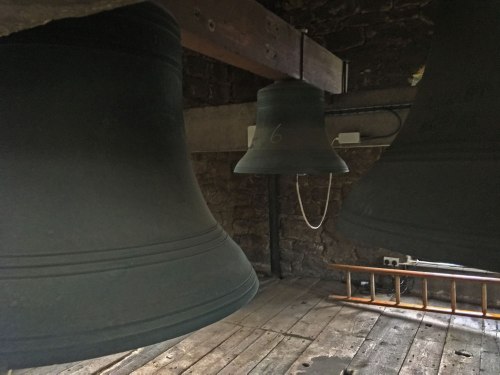
St Andrew’s Church Tower is no strong enough to cope with swinging bells any more. Instead the bells hang vertically with electronic actuators powering the hammers

The Whistle here is situated on the top of the tower. Much of the tower survives from the 12th century, notably the stone spiral staircase up to the top bell chamber. The tower can no longer take the weight of swinging bells, so these are now static and rung by means of actuators on the hammers and controlled by a timer in the church.

16. High Friars, Intu Eldon Square Shopping Centre

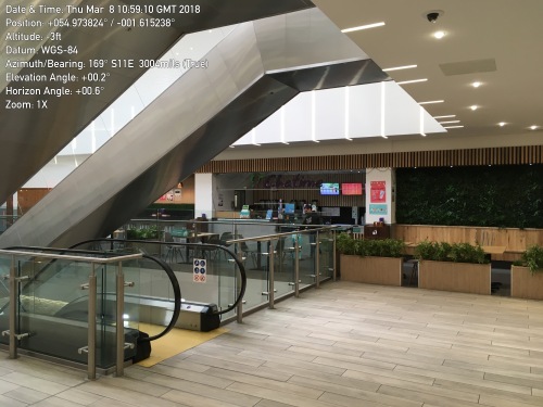
From St Andrews the wall crossed Newgate with a major gateway in the wall. Newgate was the largest structure in the wall and enlarged with a fortified barbican in the 1390. From there the line of the wall passes beneath what is now part of Eldon Square shopping centre. The original Eldon Square was an elegant formal square designed by John Dobson. This was controversially demolished in the 1970s to make way for the current shopping centre. The outside wall along the south side of Blackett Street follows the line of the town wall. Although there is no trace of the actual wall, its heritage lives on in the names of the quarters within the centre. The High Friars Mall follows the line of Friars Chare that ran through the nunnery gardens there. The opening space for the escalators beneath Eldon Leisure sits exactly on the site of Bertram Momboucher Tower and its square atrium space echoes the ghost of a tower. The original tower takes its name from Bertram Mombowcher – one of the high sheriffs of Northumbria during the reign of Edward III. This part of the town became the poorest area by the mid-19th century so atypical slum clearing fashion it was torn up and rebuilt as Blackett Street. The stones from the wall were reputedly reused to line the new sewers.
vert_angle_deg=0.2 / horiz_angle_deg=0.6

The current site of Bertram Momboucher Tower inside the shopping centre

The whistle inside the shopping centre is the closest to the public and as it’s in a relatively enclosed space has had to be specially engineered to be significantly quieter so as not to deafen shoppers. It’s still very loud though!

17. Monument entrance, Intu Eldon Square

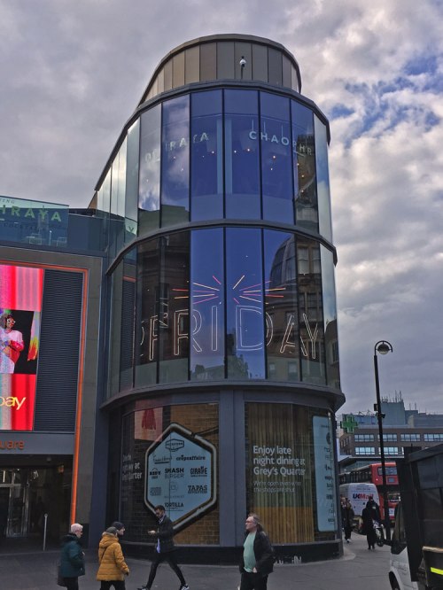
the last whistle in the piece sits overlooking the statue of Earl Grey. The outside edge of the shopping centre sits directly over the site of Ficket Tower. The entrance to the centre follows the line of Friars Chare and the wall would have run alongside it next to the current Blackett Street. You can see the site of Ficket Tower in the distinctively rounded northern flank of the entrance. The whistle here is on the roof.
IMG_7725

The rounded end to the north face of the shopping centre echoes that of the Town Wall towers and Ficket Tower that once stood on the same spot 

From here the line of the wall runs along Blackett street, across Pilgrim Street on Pilgrim Gate and back to Carliol Tower. Pilgrim Gate was demolished in 1802 when the gate became too narrow for the wagons of the day. When it was demolished the builders discovered a 24 lb cannon ball in the walls – a remnant from the siege of 1644.

All in the piece runs around 2.2 miles (3.5 km) of the town wall. Of the sites there are three Grade II or II* listed, five Grade I listed, two scheduled ancient monuments, and part of a UNESCO World Heritage site. This is by far the most complicated piece I’ve done in terms of securing permissions – with over 20 landlords, tenants and licensing bodies to appease. The install documents alone run to nearly 200 pages.

But the complexity of the various locations and their individual connections with the history of the Town Wall, for me, adds so much more depth to the overall piece and cements the piece with the place in a way that simply wouldn’t work anywhere else.
Read Full Post »

Bridge numbers. I like bridge numbers. Bridges that cross canals and railways (and motorways for that matter) all have numbers. Names are good, but numbers give you a sense of where you are. On canals they are an essential navigation aid. But bridges over rivers don’t need numbers. The difference between things you go over as opposed to things you go under I guess. Still, I’m counting these bridges over the Tees. Cow Green Dam Wall isn’t technically a bridge, so Birkdale Bridge is no.2. It’s a litle way to no.3.

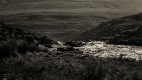
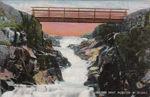
We left the river below Birkdale Bridge as it plummeted down Cauldron Snout. This cascade is more a series of cataracts over a 180m length – making this the longest waterfall in England. There’s a good clamber down the entire south side over the dolerite pillars of winsill so plenty of places to admire the power of the water as it plummets down a total of 60m. Even on relatively dry days, as the water is regulated at the dam it’s always an impressive sight.

cauldron snout brdge.jpg

There used to be a little wooden footbridge across the falls – about halfway down.  This would have given an incredible view of the torrents below. Before the reservoir was built, the river ran round a long sweeping crescent picking up speed so by the time it reached the top of Cauldron Snout it was already wild and raring to go. The wooden bridge disappears from the maps by the 1940s and a track bridge appears about where the dam wall is today. But never both together. The amazing moving bridge. There’s more of these to come further downstream..

At the base of the falls, the river meets with Maise Beck – one of its larger tributaries at this end and corners beneath the cliffs of Falcon Clints. This next section along the shadow of Cronkley Fell is wide and flat. The river here is very wide given how young it still is. It’s very shallow but very fast. From here to the top of the next waterfall, High Force – about 6 miles away – it’s got 100m to fall so it’s on a bit of a sprint while it can. The landscape here is classic glacial pasture. big wide and relatively flat land with steeply rising fells beyond. Thousands of years ago this valley was scoured out by the receding ice flows. Long before that, these carboniferous rocks stretched across to the much older Lake District and formed a border with the still separate Scotland. It’s a very old landscape indeed.

file-04-02-2017-16-56-57


As the land flattens out, so the farms start to appear. First up on the left is Widdybank Farm. As remote hill farms go, this is particularly remote.Yet along the banks of the river the pasture area is flat and fertile. Great for cattle, but still too exposed and high up to grow anything meaningful.

file-05-02-2017-12-28-44

There are no bridges for miles, but the river is wide and shallow and during the summer months certainly fordable at any number of points.

File 05-02-2017, 12 47 26.jpeg

Further along on the north bank are the remains of a pencil mill. Here the sedimentary rocks were ground down and  pressed into moulds to make pencils. The mill opened in the mid 19th Century and produced pencils – know locally as ‘widdies’ until 1890.

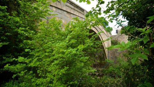
The river winds and widens until near the far end of Cronkley Fell we find Cronkley Bridge. Bridge no.3 in my book. This is a simple steel girder span over two intermediate stone pillars with a wooden deck. It’s flat and utilitarian and is probably 1950s. The main feature is its length – about 40m. We won’t see another longer bridge for over 30miles. You would normally build a bridge at its narrowest point. It’s certainly the cheapest way to build one. I imagine, as the river is shallow and with a flat rocky bed, this would be an ideal fording point, but a bridge has been marked here on maps certainly from the mid 1800s.

file-04-02-2017-16-55-13

I had planned on following the river towards High Force about a mile downstream, but a loose and very vocal dog at one of the farms clearly had other ideas, so that bit is another for a revisit. Cronkley Bridge is on the Pennine Way so it’ll be a bit busier later in the year. Also, from March the wading birds return to nest on these high moors. Today it’s almost silent, but by mid April the air here is filled with the strange whoops and warbles of Curlew and Lapwings, the buzz of snipe and the cackle of grouse – over 3/4 of England’s native Back Grouse live in these barren hills of the North Pennines.

But that’s bridge no.3 done. The next four are all walking distance from where I live so familiar territory for a bit…

Read Full Post »

Maybe it’s that new year thing when you start out with good intentions – bold ideas, long-term plans, fresh start or whatever, but I guess every new thing has to start somewhere, at sometime. It seems that the winter months are when I look ahead to the coming year and finally get to start working on new projects. There’s still some gaps in the overall view of the year, but from what’s already there I’m getting a feel for the overarching themes. While last year was more about textures and moments, this year looks like being one of spaces and voids. Strange how things find their own threads.

Last year I really got to know some of the river where I live. I spent large chunks of time watching it, filming it, photographing it, editing the results and creating the major piece of the year – ‘Waterfall‘. I’ll probably do a more in-depth post about that at some point, but for those new to the game, ‘Waterfall’ saw three white-washed field barns wrapped in slow-motion film footage of the three main waterfalls of the River Tees. Each barn became a visual cube of slow moving water in the night sky. It was big and awesome and probably the best thing I’d done in a long long time.

Since that piece I’ve had an uncomfortable relationship with the river. I used to go down there almost every day, but the daily photographing and research has probably made me over familiar now and some of its magic is somehow lost. I kind of know how it does all its tricks now.

So I needed to find a way to re-engage with the river. There are new things I need to discover. I need to find another story in it.

Then last week I caught up with Andy Carters ‘270’ project on his Calling All Station YouTube channel. Over the next 52 weeks Andy  is aiming to visit all 270 stations on the London Underground. To make it more interesting he has to pass through the ticket barriers at least once at every station – either coming or going through them, not just passing through on a train. It’s this slowing down of the travel that makes you stop, look, think and examine the familiar. About 40 stations in (starting with the boring bits of the  Jubilee Line) and I’m already hooked. Each station is documented on his blog as he goes along too, creating a comprehensive gazetteer of architectural gems and subterranean secrets beneath the capital.

Inspired by his journey, I’ve decided on mine – to visit and cross* every crossing of the River Tees from source to sea.

Bridges are fascinating things. I’ve had my own experiences in constructing them. Essentially they are practical engineering – a way of traversing in this case water. Yet as purely man made structures in what is on this route, mostly open countryside, they have a very distinctive presence within the landscape to manage.

Today I made a start. The purist in me wanted to start at the source and work progressively downstream. However, it’s still very much winter and as the Tees starts just below the summit of Cross Fell – the highest peak on the Pennines – and very much buried under snow for the next few weeks I’ve decided to scrap that and not be precious about the order in which I visit the bridges.

My first crossing then wasn’t even a bridge. It was also one of the biggest structures on the river – the dam wall at Cow Green Reservoir.

file-30-01-2017-17-02-50

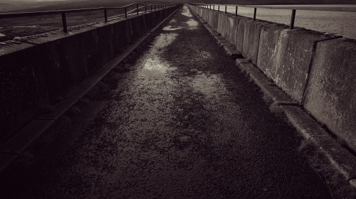
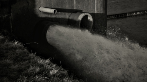
Between 1969 and 1971, a section of the Upper Tees was flooded to create the 2-mile long Cow Green Reservoir as a part of of a series of interventions to regulate the flow of water down the river for abstraction purposes. The 1/4 mile long concrete reinforced embankment holds back 40,000,000,000 litres of water (count those zeros!) while the entire river flow is regulated by sluices on the southern bank. So technically the River Tees flows beneath it, so the dam wall is a crossing.

file-30-01-2017-17-07-48file-30-01-2017-17-03-33

The reservoir sits in a natural basin of pasture land high in the North Pennines. The landscape here is a unique blend of very specific geology and rare botanical habitat. Widdybank Fell which sits along the Durham side of the water is home to the rare Blue Gentian  and the only place in the UK where alpine plants have survived since the last great ice age. The land here is fertile and remains of bronze age summer farms lie beneath the reservoir – themselves an indicator of how climate changes over time. Back then temperatures in these upper fells were around three degrees warmer. It might not sound much but the weather here is now too cold for most wading birds to breed on the reservoir. On a fairly bright day like today it felt relatively mild a few miles downstream, yet up here the shaded bays on the water are still iced over and pockets of snow lie in the heather.

file-30-01-2017-17-01-52

Today the reservoir sits in the Moorhouse National Nature Reserve – the largest nature reserve in the UK taking in the highest fells in the Pennine chain and the upper catchments of the River Tees.

The wall is an immense brutal slab of industrial infrastructure. Its scale and construction means it’s never going to blend in (whatever that means) and makes a bold statement within the landscape. Yet, the sparsity and relative bleakness of this part of the dale tolerates its monolithic brutality. The scale of the landscape seems to just swallow it up. As the river rushes quickly away from the wall thinly over bedrock, there is a greyness and roughness, that is almost alien in spirit and the concrete meets the bedrock as an ancient ancestor and the family resemblance is still there.

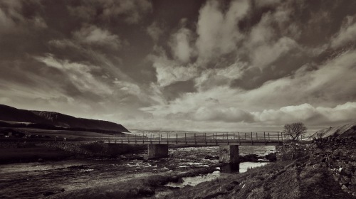
Within yards of the wall, the river passes beneath Birkdale Footbridge. This is the first of the bridges in County Durham and is still a border crossing between Durham and Cumbria. Built in 1966 – and just predating the dam wall – it’s made from a concrete span sitting on two reinforced stone pillars in the river. Like the dam, it’s a very utilitarian structure and supports a private access road and the Pennine way.

Downstream of the bridge the river disappears down a series of dramatic cataracts between basaltic columns of winsill. At a total of over 200ft, Cauldron Snout is one of the main waterfalls of the River Tees and shows how fast the water develops its wild character from the man-made sluices of the reservoir.

file-30-01-2017-17-21-18

So this is where my journey this year begins. I’ll back track when it’s warmer to find the source of the river and the only bridge beyond the reservoir, but I’m looking forward to discovering the journey of the water from the sluices as it cuts its way through the landscape towards the sea, and how people have built ways of traversing it.

It’s a long a winding story and I’m looking forward to discovering the stories and narratives of those crossing places. it’s a rich history and along the way I’m going to find Romans and Saxons, and JMW Turner and Lewis Carroll and railways and steel and plutonium. Lots of landscape and lots of engineering. And lots of walking.


*ok. so I won’t walk over the railway bridges,or motorway one and will probably give the pipe bridges a miss too

Read Full Post »

Yay! it’s raining. At last. With daily reports of flash-flooding and thunderstorms from the rest of the UK and the Glastonbury Festival declared the muddiest for years, the most our Teesdale weather could muster has been the occasional half-hearted drizzly shower. While I’m not complaining about the weeks of sunshine, heat and beautiful walking weather, now the rain has arrived it brings with it that distinct summer aroma of wet grass, and a burst of life from the ground. The air is suddenly alive.

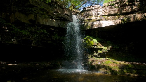
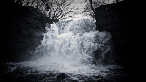
Some things are better in the rain. The River Tees is really low at the moment. The waterfalls of Upper Teesdale are little more than a trickle at the moment. Here’s Summerhill Force dribbling over Gibson’s Cave last week.

L1030830 - Version 2

Compare that to the day after Storm Desmond visited on the 5th December last year.

_DSC6973 - Version 2

OK. So this is a bit of an extreme example. But extreme things do happen.

It’s 200 years ago this year that we had a ‘Summer that never was’. A year when the world was 0.7 degrees colder than normal, harvests failed and populations starved.

a-volcano

Mount Tambora

In April 1815, in Indonesia – 8,000 miles away – the sleeping giant volcano Mt Tambora erupted. The explosion was so large it was heard over 2,000 miles away in Sumatra. The volcanic dust cloud enveloped most of the planet causing severe climatic events throughout 1816 and affecting weather patterns for years after. In North America, hard frosts were recorded right through July and the Eastern seaboard experienced a perpetual fog that lasted through the summer of 2016. In Northern Europe, the long winter extended into a very wet summer causing crops to fail. Throughout Europe food became scarce and there were violent uprisings outside government buildings in several countries. In Ireland, the failure of crops marked the start of the ‘Potato Famine’ and over the next 3 years over 100,000 people died.

Freak events that shaped our world 200 years on.

On the shores of Lake Geneva, Mary Shelley and her friends were on holiday for the summer. So bad was the weather, they were forced to stay indoors for weeks on end. To pass the time they challenged each other to tell stories. Mary Shelley wrote ‘Frankenstein – or The Modern Prometheus’ and Byron wrote ‘Darkness’ on a day when the birds went to sleep at midday. (If ever there was a historical example of first-world problems, this has to be it. While the rest of the Northern Hemisphere died from starvation, a bunch of privilaged English writers redefined gothic literature because t was a bit damp outside.)

gothic-1986-poster

Ken Russell’s 1986 film based on the events by Lake Geneva in 1816

In July 1816, JW Turner visited Teesdale on a long, extended painting tour of the North of England. He stayed at Barnard Castle and Middleton-in-Teesdale on a particularly wet week as he ventured right up the dale. By the time he reached Cauldron Snout it was really throwing it down. However, he did manage to see the falls of the River Tees at their best – full and lively.

It was the subdued light from the volcanic ash cloud that summer, along with the incessant rain which gives Turner’s painting from that trip of 1816 the substance and atmosphere that Ruskin claimed was Turner’s most effective work ever.

———–

I’ve lived in Teesdale now for two years. Two years this very week. I love living here. I love having the river just yards away from from my house – so close on still nights I can hear it falling over Low Force from my bedroom. I’ve spent so many days down there and walking up the river towards High Force and the fields, woods and fells on either side. However, I don’t really know Teesdale, let alone the wider County Durham.

IMG_6713

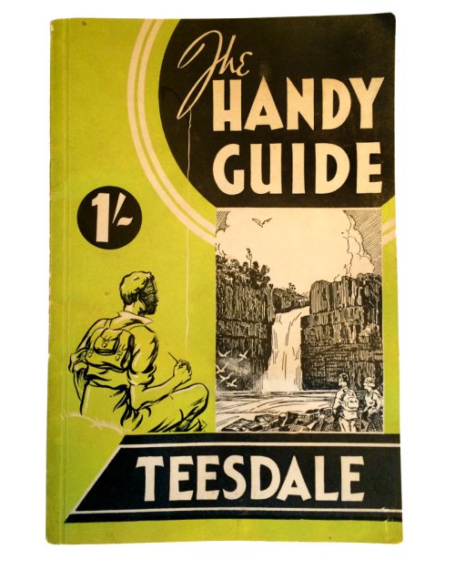
A couple of weeks ago I made a conscious effort to get to know where I now live. It was another warm and dry afternoon, and a rare weekend off from working so I thought I’d make a start to discover Teesdale properly. Having poured over books and walking guides and maps, and old OS maps and Gogle Earth, I decided to start where Turner started – at Greta Bridge on the Durham / Yorkshire border.

I knew about the temperamental River Greta from a previous project further up its course, but I’d never been down towards where it joins the River Tees. Greta Bridge was a popular spot in Turner’s day. the old road over the Pennines via Stainmore started here at the significant coaching inn of the Morrit Arms. In Turners day there were still remnants of the Roman fort there. Clearly a strategic point where the route from East to West ascends up and over the wilderness. Crossing the Greta is crossing to another world.

L1030817 - Version 2

Greta Bridge and nearby Rokeby Park became important sources of inspiration for a generation of writers and painters. Besides Walter Scott who immortalised the area in his own seminal work, the place was a key destination for the Wordsworths, Dickens, Coleridge and most of the Bloomsbury set.

The landscape here is wider. It’s greener and rolling and fertile and hospitable. And distinctly arable. A very different kind of greener.

L1030798 - Version 2

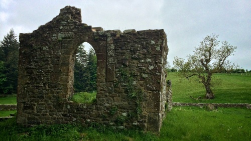
A short walk up the Greta brings you to the ruin of St Mary’s church in Brignall. Nestling in the bottom of the valley. There’s not much left of it now. The new church was built further up the hill in the second half of the 19th Century and reused much of the stone from from the old church.

IMG_6398 - Version 2L1030715 - Version 2

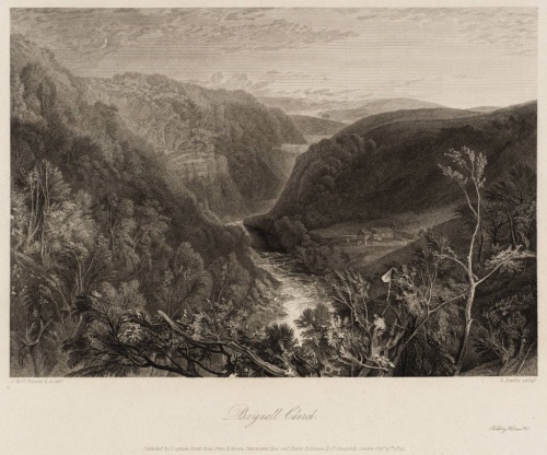
Turner’s view of the church reveals much about attitudes to landscape in the early 19th century. It’s actually a remnant of the trend of 18th century landscape attitudes – where hills were so dramatic as to be scary: “it was almost the whole duty of all hill scenery to inspire alarm, and every painter who wished to give a good impression of any particular place always painted it as if it were twice its real size” to quote one of Turner’s picture editors.

Brignall Church 1822 by Joseph Mallord William Turner 1775-1851

Brignall Church 1822 Joseph Mallord William Turner 1775-1851 Purchased 1986 http://www.tate.org.uk/art/work/T04453

It’s also a view point that doesn’t actually exist, again to increase the visual impact. The large tree in the foreground is one sketched in Rokeby Park. Topographic accuracy wasn’t important in the appreciation of landscape in 1816. What mattered most was conveying the essence of place. These were places most people would never see in real life so were designed to excite the imagination of the viewers. Of a place that is of somewhere else. The early tourists came to gawp and the awe and wonder of the place and the people that went before, conjuring up stories to populate somewhere new and unknown.
Things have changed so much in the intervening two centuries that it’s hard for us to begin to understand how people viewed the landscape of Teesdale. So much changed with the invention of photography that we can only know what somewhere really looks like. The visual and emotional impacts are much more subdued and taken for granted.

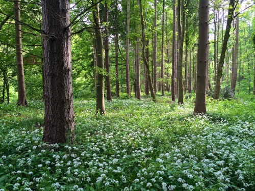
The woods around the old church at Brignall actually look like this:

IMG_6442 - Version 2 (1)

They smelled so good, I went home and had them on my pizza.

IMG_6449

Read Full Post »

So, the snow’s back. Seems it barely went away this year. This latest lot has been a little extreme. I’ve got quite used to being snowed-in. I quite like the forced isolation really. But this little lot has had a good go at burying me. This morning I needed to get more logs for the cooker and had to climb out of a window to get outside!

Last week I had to cancel a presentation I was due to do in Lancashire because I was snowed in. It was a shame I couldn’t get there as I’d been building up to it as a big reveal for a new piece I’d been working on. It was big, bold  and flying. The brief I’d been given just eight weeks before was to come up with something unexpected, ambitious and with a wow factor. I was aching to see if I’d actually got something to provoke a real reaction with the audience.

The project had started at the beginning of February. The start date had been postponed a number of times due to snow and bad weather. I should have taken this as an omen on hindsight. The folks at Mid Pennine Arts had asked me to look at the West Pennine Moors and create an idea for a future piece as a response. So on the very first day we trudged through the snow up to Jubilee Tower above Darwen to see what I was dealing with.

first view of West Pennine Moors

Prior to this I had never heard of the West Pennine Moors, let alone visited them. I was starting from a point of zero information. My landscape works are about uncovering what makes up the landscape and looking at it beyond just  surface. These things are easier in places like the Lake District which has a rich cultural history and people have documented the changes there through art and poetry for 200 years. But every landscape has its stories and narrative,  just need unlocking.

The West Pennine Moors are a collection of moderate sized upland areas in the South Pennines, surrounded by the Lancashire Mill towns of Blackburn, Accrington, Bury, Bolton and Chorley. In a way they are a clearly defined area within Victorian industrial sprawl. However, this part of the south Pennines has several moorland expanses on the outer edges of Manchester, and one of the challenges was to see what made these relatively minor moorlands unique and distinct from its neighbours.

The starting point for the brief was the three towers which mark the corners of the area – Jubilee Tower at Darwen, Peel Tower near Holcombe and Rivington Pike tower above Horwich.

Peel Tower

Peel Tower is a tall, angular structure on the edge of Holcombe Moor. Built by public subscription (today we’d call it crowd-funding I guess), it commemorates Sir Robert Peel – a former prime minister and founder of the police force.

Rivington Pike

The tower on Rivington Pike is a little more modest. Sitting on top of a natural peak beside Winter Hill. Built as a hunting lodge in the 18th Century, it’s the oldest of the towers on the moors. Although only 6 metres high it still has a commanding presence on the hill and is a prominent landmark from the train between Chorley and Bolton and from the M61.

Darwen Tower

Darwen Tower is the most visible of the towers and can be seen from almost all the moors in the area. It’s also the only one still open daily to go up. Like Peel Tower, it was paid for by locals to mark Queen Victoria’s Golden Jubilee (hence the official name), but also, more importantly to mark the opening up of the moors for everyone to access. This was one of the first moors with a public right to roam following protests and mass trespasses which predate those at Kinder Scout by over 30 years.

Opening Darwen Tower

opening of Darwen Tower (from http://www.cottontown.org)

Of course these towers are all essentially follies. There are plenty more elsewhere in the area, particularly at Rivington:

Moor tower at Rivington

Moor towers are not unique to the West Pennine Moors. In England there’s a bit of a tradition for building towers on hills for the fun of it. Some were built as lookout posts for hunting (as at Rivington Pike), others as ornaments in the landscape (my favourite type) and even some, bizarrely, built as job creation schemes – something for the locals to do. A kind of 18th century YTS. The tower on Leith Hill in Surrey was built to bring the total height up to 1,000 ft above sea level (small hills down south – bless).

Leith Hill Tower

Leith Hill Tower, Surrey – its gothic architecture makes it a lure for dodgy goth bands

Previous to this spate of random tower-building, the tops of hills have been used for centuries as natural vantage points. The tower on Rivington Pike was built using the stone from a previous signalling beacon, which in turn was built on the site of a standing stone. Walking across the moors there are man-made structures on almost every high point

.shelter on Great Hill

Great Hill has a wind shelter. Much needed on the day I first went up.

Standing stone on Cheetham Close

There’s a stone circle on Cheetham Close

round loaf cairn

While Round Loaf on Anglezarke Moor is a man-made hill of unknown origin, topped by a cairn. Sitting in a bog, the difference in vegetation on the better drained hill is very obvious from satellite pics.

Round loaf from the air

On top of that are the half-dozen triangulation markers (trig points). Built between 1935 and 1960, these were used to map the whole of the UK with an accuracy down to 10 metres. By measuring the angles between one trig point and two others, you got very accurate measurements of the landscape. The same technique is deployed by GPS, only using three satellites rather than lumps of concrete. Trig points have to be on places where they have good all round visibility, so are generally on the highest points around.

Hog Lowe Pike trig point

Using triangulation calculations between the points you could not only determine distances, but also elevation. It’s a classic example of using elevated points for getting a good idea of where you are.

using a trig point

An Ordnance Survey team working on the retriangulation (from Ordnance Survey blog)

But to use triangulation points, you need the right equipment and lots of know-how and charts and stuff to get your bearings. Without that it’s still very difficult to know where you are without visual reference points. Back up in Cumbria the fells often have very distinct profiles, so when I look out of my window at the fells on the horizon, I can identify a number of places. On a clear day I can see lined up beyond Wild Boar fell, the distant peaks of the Yorkshire Dales – Wernside and Ingleborough. Further west are the Howgill fells, then swinging round to the Lakeland fells and the identifiable twin peaks of Blencathra to the far right.

On the West Pennine Moors, the landscape is less distinct. From a distance one hill looks mostly like any other. The towers then come into their own as giant triangulation points. Rivington Tower is tucked behind Winter Hill for most of the area. However, Winter Hill with its vast communication masts, is arguably the fourth tower of the moors. So  from the top of Darwen Tower, the landscape of the moors begins to have some shape.

sightlines

Lines of sight between trig points on the West Pennine Moors

Getting out on the top of the moors has always clearly been part of the culture of the surrounding communities. The protests and opening up of Darwen Moor was followed by mass trespasses at Smithills near Bolton. On that occasion the moor road was finally opened to the public in 1996. Getting up the moors part and parcel of our relationship with the land. It gives us a sense of place in the wider world, and a humbling of scale.

In my response to wandering the moors, I wanted to do something which helped people connect with the whole of the moors. Find a way to get a sense of place and overall geography. In other places I could have designed a viewing pavilion with things to see. Only, in the West Pennine Moors, there aren’t things to see. Beyond any of the towers there aren’t any visual reference points. My solution – to create those visual reference points. A more comprehensible system of triangulation points marking every point above 1,o00 ft. So that standing by any one marker you can see and identify every other marker. Even from the bottom of the valleys you would be able to map the peaks of the uplands.

Locations

All peaks above 1,000ft (330m). White markers are trig points

The problem was how to make them visible enough to be useable. Towers are big, solid constructions. It’s really, really windy up the top. This in itself is part of the character of the moors. To the west are the plains out to the Lancashire Coast where the prevailing weather rolls in relentlessly without obstruction. Permanent structures big enough to be seen from any other point would be very costly and not appropriate on a rare wilderness landscape. Temporary structures would again be susceptible to weather conditions too much.

The solution? Why battle the elements, when you can use them.

The Flying Towers are a series of flying markers, each equivalent in size to Rivington Pike tower – the first of the moor towers – which fly around 100ft above the ground at each peak across the entire West Pennine Moors for a few days.

mock up of flying towers

It’s only an idea at the moment. An embryonic one. I’m currently wondering if there should be more of them – should they also fly from sites in-between the moors? At present the idea is for 25 of these kites. A hundred would be even more impressive visually.

It would have been good last week to see what the reaction was when I first unveiled it. I guess that moment is gone – the big reveal more an oozing out now. Still, it’s an idea. It’s a response. Whether it’s the response people were expecting, whether it’ll ever happen, well that’s for another day. A less snowy one hopefully.

Read Full Post »

Where are we?

At this moment I’m somewhere on the Howgill fells again. I can see the M6, Lambrigg windfarm and the old viaduct near Beckfoot, however if I had to give directions to someone else then I don’t really know where I am. I sort of followed some roads out of Sedbergh in an upward direction. When the road I was on went into open fell then I pulled over and walked up the fell beside me.
Fortunately my phone knows where I am…

So that’s OK then.

Maps have been on my mind this week:

Routing through boxes in the spare room I found the Snark Hunting Map my wife  bought for me for my birthday a few years back.

Snark Hunting Map - 1794

She got it from the shop at the end of the road we were living on at the time. It was a small antiquarian bookshop in what felt like someone’s front room. I collect illustrations of Alice through the Looking Glass and the shopkeeper fished this print out for her. The Hunting of the Snark is one of Lewis Carroll’s lesser known works, but in many ways a more superior piece than either of the Alice Books. It loosely describes a hunting trip to find a mysterious monster (the Snark). When asked what a Snark was, Carroll would always say he hadn’t a clue. Interestingly Christo and the late Jeanne-Claude confessed much the same about most of their works. But I digress. In the Snark, the Bellman produces a blank map to guide them over the sea:

He had bought a large map representing the sea,
Without the least vestige of land:
And the crew were much pleased when they found it to be
A map they could all understand.

“What’s the good of Mercator’s North Poles and Equators,
Tropics, Zones, and Meridian Lines?”
So the Bellman would cry: and the crew would reply
“They are merely conventional signs!

“Other maps are such shapes, with their islands and capes!
But we’ve got our brave Captain to thank:”
(So the crew would protest) “that he’s bought us the best—
A perfect and absolute blank!”

In fact this map predates Carroll. Mine comes from the late 18th century and was probably from a vast book of carefully drawn maps. I presume it’s a page of open sea or desert, but could easily be any featureless landscape. In isolation the map is meaningless but probably made sense in the context of the book.

Another map from this week was the draft map of a trail of some of my work being devised in a forest somewhere. I can’t say what or where yet as it’s all top secret at the moment. All the pieces are in place now and apparently look fantastic. Still, I now have a map of where they all are so I might go and have a hunt for them myself soon.

Read Full Post »