Feeds:
Posts
Comments

Posts Tagged ‘architecture’

I always knew this was going to be a longtime series, but it seems it was May 2017 when I last posted something on this project.

Quick recap: I’m visiting all the crossings over the River Tees in North East* England, from source to sea. I’m interested in the role of the river in the landscape generally but also how people have sought to get from one side to the other and why. It’s a long and fascinating history of people in their landscape, and I don’t think there’s another river with such variety and heritage as the Tees. Also, it’s where I live. So far I’ve done five of them – four bridges and a dam wall and they’ve all been in order. I’ve since visited another three with the intention of posting about them, but for some reason I hadn’t actually done so. I’ll probably go back and revisit these before posting them to refresh my memory.

So, being that quiet time between Christmas and New Year, and armed with a new pair of walking boots, I decided to explore another couple of bridges on the route. To confuse things a little, they’re further downstream than I’d got up to. And I did them in reverse order. But it’s two more off the list..

I live in Upper Teesdale – where the river is wild and the centre of the landscape as the fells all roll down to the river at the bottom of this long and narrow valley. It’s very rural and very remote – there are no shops and even the nearest pub is a good couple of miles away across the fields. So to get anything I generally have to drive a fair way.

Barnard Castle is not a place I really know that well. It’s the nearest market town, but it’s not that big. I only ever go to Barnard Castle because I have to, not because I want to. It’s not far enough to be exotic or a day trip, and not big enough to be the solution for all the complicated things I need that I can’t get locally, so I really don’t go there that often. So the bridges of the Tees seemed a good excuse to go and discover bits of the town I didn’t know.

APC_0181.JPG

I started at the Bowes Museum – one of the few reasons I go to the town, and mostly because of work, but as local museums and art galleries go, it really does take some beating and I know I’m really lucky to have such a place on my doorstep.

A short stroll across the road between the old vicarage and another large victorian country house you find yourself in the open fields of the Demesnes. These were the fields owned by the lord of the castle for his own use rather than tenanted farmers. They’re now an open space for the use of the people of the town. The well trodden footpath leads down behind the waterworks to the river. Here the river is wide and shallow and skips over small rocks scattered across its width. The route of the river is through a shallow gorge with occasional bare rock cliff faces. Very quickly you are out of the town and into open countryside and it’s all very tranquil.

L1210681.jpg

L1210705.jpg

L1210688.jpg

Soon you get a first glimpse of the ruins of Egglestone Abbey on the other side of the river. Here the river gets rockier and more turbulent as it narrows. There are the remains of the Abbey Mill footing into the water on the far side. A short wooded slope brings you up to the top of Abbey Bridge.

L1210722.jpg

The steep woods around the bridge make it hard to get a good look at the single stone arch itself, but being the middle of winter, it’s also the time for seeing glimpses through the bare foliage.

L1210727.jpg

The bridge itself is a sturdy affair – it’s the diversionary route for vehicles too heavy for Barnard Castle bridge and Whorlton Bridge either side and has the battle scars of the wagons too big for the sharp turn onto it as a result.

The bridge was built in 1773 by the Morrits of nearby Rokeby (yes, that Rokeby – Turner, Walter Scott etc.) who wanetd better access from their estate to Barnard Castle. A single track crossing, it has distinctive castellated parapets and refuges above the arch pillars. On the south side are two octagonal enclosures – the remains of the toll booths in use up until the 1950s.

L1210735.jpg

It’s a very high bridge with good views of the river from the top as it passes in a rocky and turbulent gorge beneath.

L1210734

Crossing the bridge, I turned back on the other side, past the impressive 12th Century ruins of Egglestone Abbey up on its rocky vantage point. Beneath the foot of the abbey the road crosses a small beck beside the river. This was originally a ford and the 17th century packhorse bridge sits beside it. Still in great condition, but too steep and narrow for cars.

L1210758.jpg

The footpath leaves the road when it deviates away from the river and crosses a handful of fields above the wooded gorge. Again, the leafless trees giving glimpses of the landscape beyond.

L1210780.jpg

The trail passes through a caravan park on the banks of the river. There’s something quite surreal about these places – like an out of place suburbia existing in its own well ordered world. The footpath quickly reaches the outskirts of the town and the mill buildings along the rivers edge to the north.

APC_0177

Thorngate Bridge is a long, green iron girder bridge spanning the shallow and wide river on the exit of a sharp bend. Built in 1881, the bridge replaced a lightweight three span bridge on the site that was washed away within 10 years. Before that the shallow river was crossed at this point by stepping stones.

L1210788.jpg

Thorngate Bridge is in three spans on two short pillars. The main span in the centre being over 50m long. The bridge remains largely unaltered from the day it was built – a very utilitarian footbridge made from steel and cast iron girders with a wooden walkway. The lamp brackets at either end are now empty and were the only source of illumination. The bridge was built to enable workers from the Yorkshire side of the river to get to work in the 19thC mill on the north bank.

L1210791.jpg

The wool industry was a major part of the town of Barnard Castle. Beyond the Victorian carpet mills down by the river,  the short walk back up Thorngate passes some of the most fascinating 17th and 18th C houses with their weaving loft windows up on the top floors.

L1210805.jpg

It’s been interesting to explore somewhere I kind of know but don’t really know. There’s another 4 crossings around the town which I’m looking forward to discovering and getting more familiar with. Barnard Castle is also the outer limit to what I consider to be ‘local’. Beyond the town the landscape is very different and the route goes to places that are mostly new to me. Hopefully it won’t be another another 18 months before I do more exploring.


*technically the river Tees starts in Cumbria which is technically in the North West, but borders are a bit vague here…

Read Full Post »

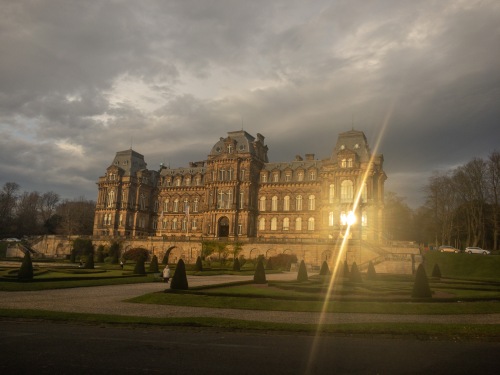
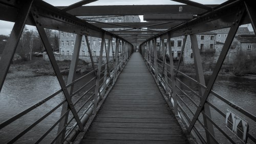
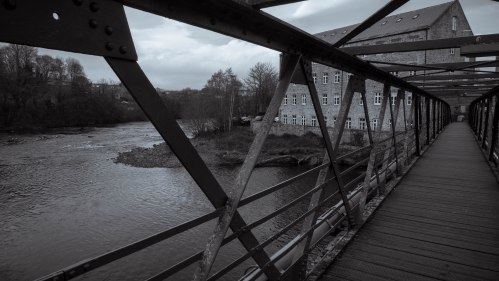
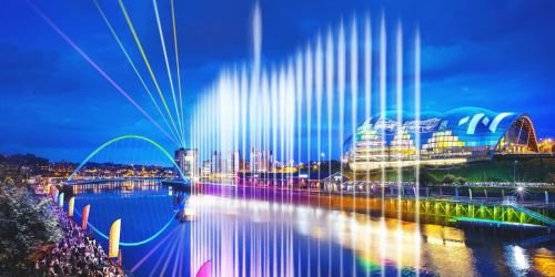
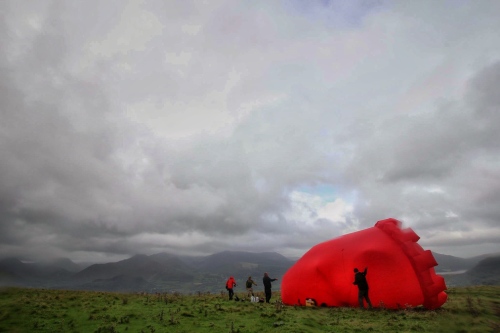
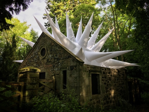
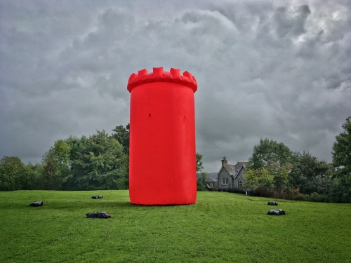
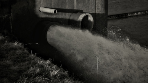
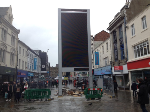
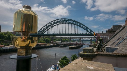
Whistle, as an installation, looks to celebrate the engineering heritage of the North of England, but also looks at who we are in the North and the sense of place.

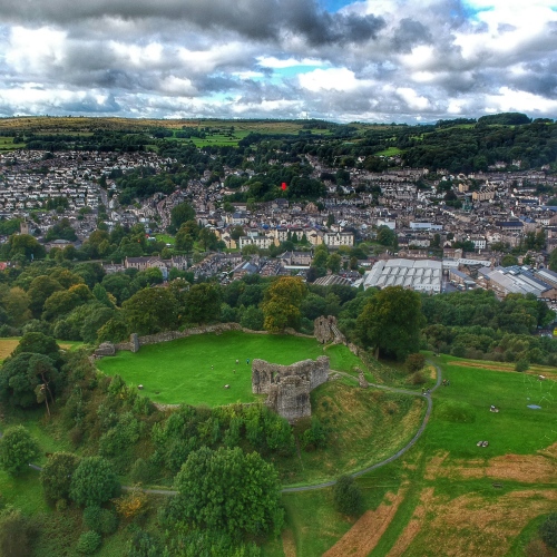
The Great Exhibition of the North could have been anywhere north of Cheshire (I know, don’t get me started on basic geography). However, it’s ended up in Gateshead and Newcastle, so I wanted to see what defines the place in order to start a conversation about its future trajectory. Where does it come from?

town wall map 3

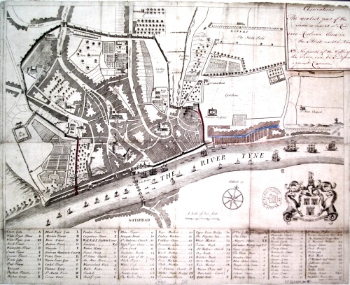
An early 18th century map of Newcastle clearly showing the route of the wall

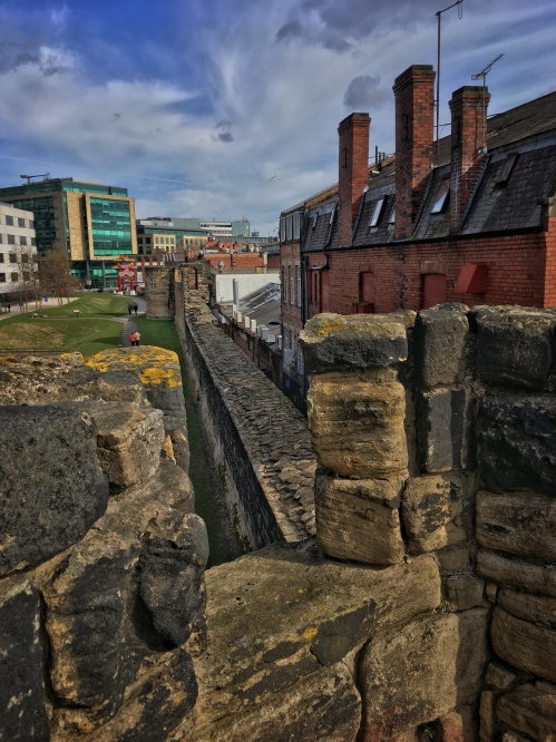
The Town Wall was built around Newcastle around the 12th Century – primarily to defend it from raiding parties from across the Scottish Border. It was typically 24 ft high (8m) and seven feet (2.5m) thick. There were six main gates – including Westgate and Newgate – and 17 towers – of which parts of six still remain. At its prime it was considered the most impressive town or city wall in the whole of England and was only breached once – by the Scots during the English Civil War. Although over the centuries it fell into disrepair, most of the wall survived into the late 19th Century and there are photographs of most of the towers before the late Victorian redevelopment of the city centre. It’s important to note that Newcastle never had a City wall – it didn’t become a city until the 1890s, by which time most of the wall was in ruins.

Although the wall is by no means complete now, there are surprisingly large amounts still standing, and even in the absent sections its route still survives.

wall-map-web

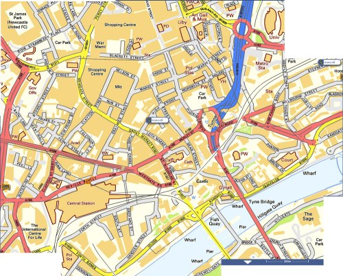
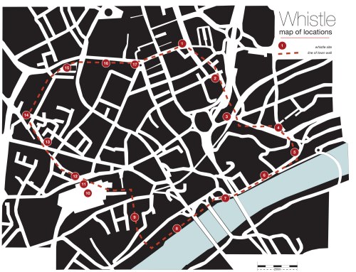
The current online map on Street Map shows the route of the wall as a dotted line

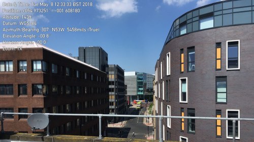
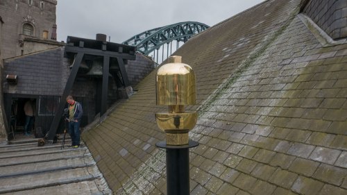
The challenge for the installation was to find sufficient sites around the wall to place whistles. As they are powered by cylinders of compressed air, the sites had to be secure. At around 130dB they are also very loud, so they had to be well away from ear-level or a safe distance away from the public. The simplest place to put them was on the roof of buildings. That meant finding and securing premises with flat roofs and good access. With a target of 18 venues across an entire city this was far from straight forward. Besides the medieval structures of the actual wall, most of the other buildings along the line of the wall were part of its subsequent history with their own architectural interest. Newcastle is a city rich in history and architectural heritage. Outside of London it has the highest number of historical buildings in England. Newcastle has 53 grade I listed buildings, 153 grade two-star, 558 grade two, 42 scheduled ancient monuments and 12 conservation areas. This in turn created its own set of issues and logistics in terms of getting permissions. In the end 17 locations were identified, which in turn held their own connection to the town wall and the history of the city:

whistle-master-mapv3-web

1: Newcastle City Library – New Bridge Street West.

This was a relatively easy starting point for me as I had untaken a short residency there last year and had a good relationship with the team there. I’d already been up on the roof so I knew it was a great place to host a whistle.

003773:Carliol Tower Newcastle upon Tyne Richardson T.M.  1820?

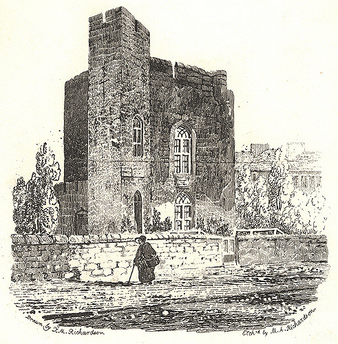
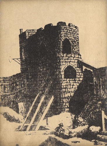
A drawing from 1825 of Carliol Tower – then a private house

IMG_4221

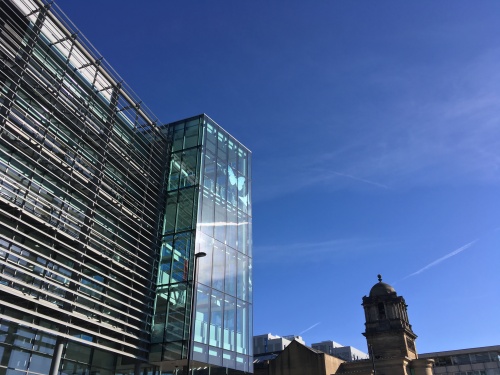
The 2009 City Library building. Note the angled entrance atrium set at the same angle as the original tower (above)

The current city library was completed in 2009 and was the third library building on the site. The previous one designed by Sir Basil Spence – architect of Coventry Cathedral and Trawsfyndd power station amongst many others – was part of T Dan Smith’s vision for Newcastle’s ‘City in the Sky’ network of elevated walkways. However, by the millennium it was deemed too dark and oppressive and no longer fit for purpose and demolished in 2007. The new library was built to be future proofed as the role of libraries evolved. Built on the site of Carliol Tower on the north-east corner of the town wall, the new facade of the library echoes the idea of a tower and is orientated to match the original 12th century tower. There are some stones from the town wall recovered during the works on display inside.

2: Euro Hostel  – Carliol Square.

The next tower along the wall from the library – Plummer Tower – still exists. Originally known as Carliol Croft Tower, it was home to the guild of Cutlers, then to the Guild of Masons in the 18th Century who subsequently enlarged the building to the street to how it is today. It’s now home to a team of architects who specialise in historic buildings.

IMG_7730

Plummer Tower

IMG_8810

The view back to the library from the Euro Hostel Roof

Unfortunately the tower has a pitched roof behind the front parapet and with no easy access up there it couldn’t be easily used for hosting a whistle. Instead, the whistle is on top of the Euro Hostel opposite. This has a clear line of sight to the whistle on the library, but also has its own town wall history. The Hostel sits on the site of the town prison. Closed in 1928, you can still see the old execution chamber out the back. ‘The Ware Rooms’ bar is named after the place where one of its former inmates hid his stash of stolen jewellery.

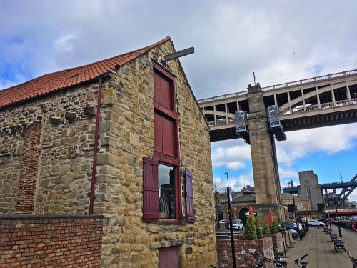
3: Holy Jesus Hospital – City Road

The motorway slices unceremoniously through the line of the wall, with the mainline railway intersecting it from the opposite direction removing all traces of the wall itself. The next tower along the line – Austin Tower – probably lies somewhere beneath Manors Car Park.

IMG_4324 2

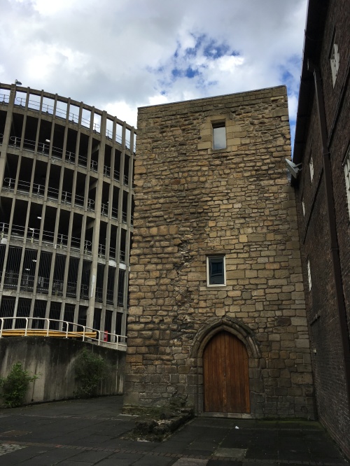
Austin Friary Tower. The part to the right of the door is original and contemporary with the Town Wall. To the left is the wonderful helix ramp on Manors Car Park. The original Austin Tower lies beneath the car park somewhere.

The next nearest spot is Austin Friar’s Tower. Austin Friary was home to a group of Augustinian monks from the 13th Century. The 14th Century tower is all that remains of the friary, although it is now attached to Holy Jesus Hospital – a 17th century building used to offer lodgings – hospitality – to freemen of the city. This is now one of the oldest brick-built buildings still in use. The tower was altered in the 16th century after the dissolution of the monasteries, and became a strong room to protect valuables in the event of the town wall being breached.

The Whistle was to have been installed on the roof of the tower – now in the hands of the National Trust – however, the access costs and logistics were escalating rapidly so this one had to be postponed at a late stage.

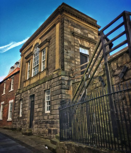
4: Sallyport Tower – Tower Street

This building straddles the meeting point of the town wall and Hadrian’s wall. Built on the base of a roman tower, this is the oldest site on the wall. The gate gets its name from being the route the army would rush out to engage with any attacking party – where they would ‘sally forth’. The tower was mostly destroyed in the siege of 1644 – the only time the wall was breached. The building was restored in 1716 with an extension on the top by the Guild of Shipwrights and Carpenters who used it as a meeting room.

File 24-01-2018, 12 13 41

Sallyport Tower. The foundations are Roman, the ground floor is mostly the original wall. The upper storey is a 17th century addition

The building is currently being run as a wedding venue so the whistle isn’t permanent here.

5: The Jolly Fisherman on the Quayside – Milk Market

From Sallyport Tower, the wall curved gently down to the river. There was no wall as such built along the quayside with the river itself forming the main defence.

IMG_4307 2

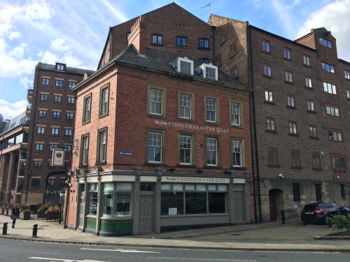
The Tyne Inn pub on the corner of Milk Market. Note the use of stone on the next door building following the line of the Town Wall

The pub most recently known as ‘the Jolly Fisherman’ or the ‘Waterline’ or even the ‘Tyne Inn’ is a grade II listed building built as a pub in 1904. This sat on the corner of the Milk Market and was once part of the busy quayside activity. The ground floor of the building along Milk Market reflects the line of the wall that ran down to the river along this point.

The pub is now part of the ‘Tomahawk’ restaurant on the Quayside. The whistle here sits on top of the hanging sign bracket.

6: Live Buildings – 55 Quayside

This relatively new building is one of the few sites without historical precedent. Sandwiched between a 19th Century quayside inn and the 18th century customs house, in never the less has an unparalleled view of the river and directly opposite the Sage building. From the balcony you also see the rooftops of the neighbouring buildings with a clear view of the bell on the roof of the Customs house next door. A reminder of a time when sound played a bigger role in signalling and communication across the city.

L1140038

Probably the best view from the Quayside. Next door is the Customs House, complete with bell on the roof

The building is now home to Zerolight – one of the ever-growing number of tech and software companies in the city. Here they develop virtual and augmented reality technologies for the luxury car market.

7: Guildhall, Sandhill

The original plan was to site a couple of whistles on the towers of the Tyne Bridge – it being an unmistakable icon of the city. However, every summer the bridge and surrounding buildings become nesting sites for rare kittiwakes. These small sea birds normally nest on cliffs above the sea, but since the 1950s this has become one of only two inland nesting sites for the birds in the world. So the Tye Bridge and many other sites along the quayside cannot be used or accessed during the breeding season.

L1140055

The whistle installed on the roof of the Guildhall. The original bells can clearly be seen on the far end

The Guildhall beneath the Tyne Bridge is one of the frequently used nesting sites. However Kittiwakes are fussy birds and only nest where they can see water. So the side facing away from the river is free from nesting birds.

The Guildhall is a Grade I listed building dating from 1665. Built as the seat of local power it was home to the various Guilds who had their individual meeting rooms at each of the castle towers. It was the town hall until the end of the 19th Century when the town became a city. It’s been redesigned and extended at several points over the centuries – the curved east end was designed for the fish market by notable local architect and town planner John Dobson. On the roof is a cupola with a chiming clock. However, below the clock on the north side is an earlier set of bells with the chiming mechanism within the central roof. More reminders of the use of sound within the cityscape.

8: Quayside Inn, 35 Close

This is the last surviving of the original quayside warehouses. From the 16th century this part of the riverside was a maze of narrow streets and houses with numerous warehouses lining the quayside beneath where the High Level Bridge is today. Both sides of the river were busy with ships being loaded and unloaded.

On the 6th October 1854, a fire broke out at Wilson’s worsted mill on the Gateshead side of the river. This rapidly spread to a nearby chemical works which subsequently exploded. Stones were shot hundreds of metres across the river. The force of the blast destroyed the riverside buildings in Gateshead and ripped off the roofs and blew in the shop fronts on Newcastle’s quayside. Burning debris quickly spread through the densely packed buildings along the quayside on the Newcastle side and before long the twin fires decimated both cities. The fire could be watched from the newly opened High Level Bridge.

IMG_8147

35 Close sitting beneath Stephenson’s High Level Bridge.

What is now the Quayside Inn is the only building with a riverside frontage to survive. This is now a Grade II* listed building. The whistle is on the outside of the loft doors overlooking the river. This building would have been right on the edge of the river. The quayside has since been infilled so it sits nearly 10 metres in.

9: The Town Wall, Orchard Street

This is one of two lengths of intact town wall remaining. About 80 metres of the wall, most of it the full eight metres high, run along Orchard Street from Forth Street. A fruit orchard grew along this stretch of wall – hence the name. In the 19th century a works building was built into the west side of the wall where you can still see the post holes for the rafters.

IMG_8165

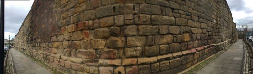
The wall along Orchard Street

A whistle was planned to sit in top of the wall along the walkway. However, access costs started to escalate so this site had to be dropped late on.

10: Central Station main concourse

From Orchard street the wall took a straight line across where the railway now stands before curving round through what is now the main station . With commanding views both to the west and south over the river valley there were three towers within the footprint of the station: Neville Tower stood at the far east end of the platforms and was the meeting hall for ‘the company of Wallers Bricklayers and Plaisterers’. West Spital Tower stood more or less on the concourse and got its name from the nearby St Mary’s Hospital. Stank Tower was on the corner of the entrance portico.

Snapseed 11

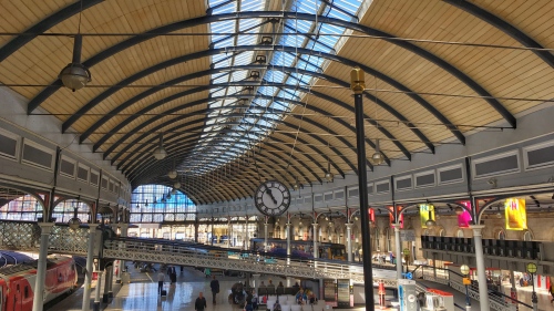
The elegantly sweeping curve of Central Station’s roof

Central Station sits on an elegant sweeping curve, accentuated by the vast ironwork roof. The original station building was designed by John Dobson and featured the first great train shed roof, built the same year as the William Paxton Great Exhibition Palace and so considered the cutting edge of architecture of the time. John Dobson won a medal in Paris in 1858 for inventing the rollers used to create the curved girders. The station was officially opened by Queen Victoria and Prince Albert in 1850 when it was mostly just a roof and some facades. The main station buildings weren’t finished in time! Their crests can be seen in the roof trusses.

11. Central Station entrance portico

Stank Tower sat on the outside corner of the entrance portico – just beyond the Cafe Nero kiosk. The original plan for the portico was for it to run the entire length of the station . the arches becoming alcoves each with its own statue. However, the scale and associated cost was revisited and a simpler portico was built as survives today.

Newcastle-Central

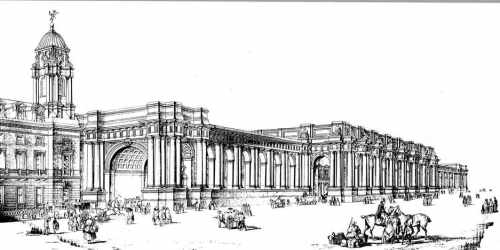
The original plan was for a portico running the entire length of the station

Central Station’s John Dobson lineage and importance in the development of the railway station has earned it a Grade I listing. The connection between the railway engineering aspects of ‘Whistle’ and its location are undoubtedly strongest at the station. By having two whistles within the station  – both indoors and in close proximity, the station is also by far the loudest and most obvious location. The dissonance between the whistles and the lively acoustic make it quite an experience on its own.

Snapseed-14

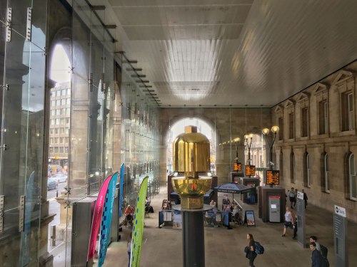
Whistle in a much more modestly sized entrance portico

12. Gunner House

From Stank Tower the wall crossed Neville street diagonally and continued along that line up Pink Lane. Gunner House takes its name from Gunner Tower which stood on the site. You can see the base of the original tower outside the Town Wall pub next door (which also serves a very drinkable   and exclusive ‘Toon Waal’ beer). Gunner Tower became the meeting room for the ‘incorporated company of Slaters and Tylers’. The wall along Pink Lane was removed by the 19th Century.

015014:Gunner Tower Newcastle upon Tyne

A drawing from around 1825 showing Gunner Tower as it remained then. The current Gunner House sits next door and is home to a Subway sandwich shop

14. Heber Tower

I know – there’s no number 13. Certainly unlucky for some – the site of whistle no.13 was never granted permission so was cancelled quite early on.

No. 14 however is on the wall itself. Heber Tower sits at the corner of the most complete section of wall still standing. West walls runs from Durham Tower, past Heber Tower, Morden Tower and ending with the remains of Ever Tower. Like Durham Tower, Heber Tower survives almost intact as when it was first built in the 13th century. Access to the walkway is via one of two internal staircases. Along the top of the wall you can clearly see the walkway and how it went through the intermediate sentry towers. From the 15th century the tower became the meeting place and was maintained by the Guild of Felt-makers, Curriers, and Armourers. In the 19th century the tower was used by a blacksmiths.

Snapseed 17.jpg

View along the top of the wall from Heber Tower looking towards Merton Tower. The Fosse – or Town Ditch – can just be seen on the left. In the foreground is one of the 13th century carved heads

The top of the tower overlooks the last remnant of the ditch that ran the length of the wall as part of the town defences. The parapet wall on the tower is pretty much all intact, complete with 13th century carved heads on the inside keeping guard. The whole of the West Walls is Grade I listed and a Scheduled Ancient Monument.

Snapseed 15.jpg

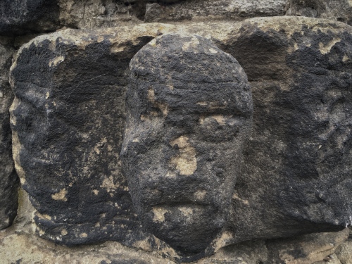
Another of the carved heads on the top of Heber Tower

15. St Andrew’s Parish Church

The churchyard at St Andrews, sitting amongst the hustle and bustle of a busy city, is a surprisingly calm and quiet space. The church was here long before the wall. the records show how graves had to me moved to allow the wall to run within its grounds. There is another large intact section of wall within the grounds – the shops along one side of Gallowgate were built on top of the wall – the present Gallowgate being much higher than it originally was – remember this would have been a ditch too. In the corner would have stood Andrew Tower.

003771:Andrew Tower Newcastle upon Tyne Richardson T.M. 1825?

A drawing C1825 showing Andrew Tower with the parish church tower behind. In the distance is the imposing Newgate

The church dates from the 12th century although much of the existing church dates from much later and includes a Lady Chapel by John Dobson. outside the porch is the grave of composer Charles Alison, who died after being caught in an unexpected blizzard in May.

bells

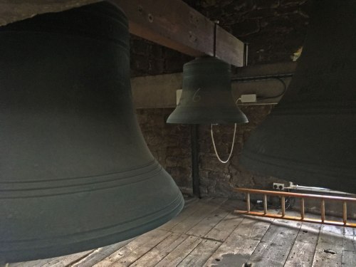
St Andrew’s Church Tower is no strong enough to cope with swinging bells any more. Instead the bells hang vertically with electronic actuators powering the hammers

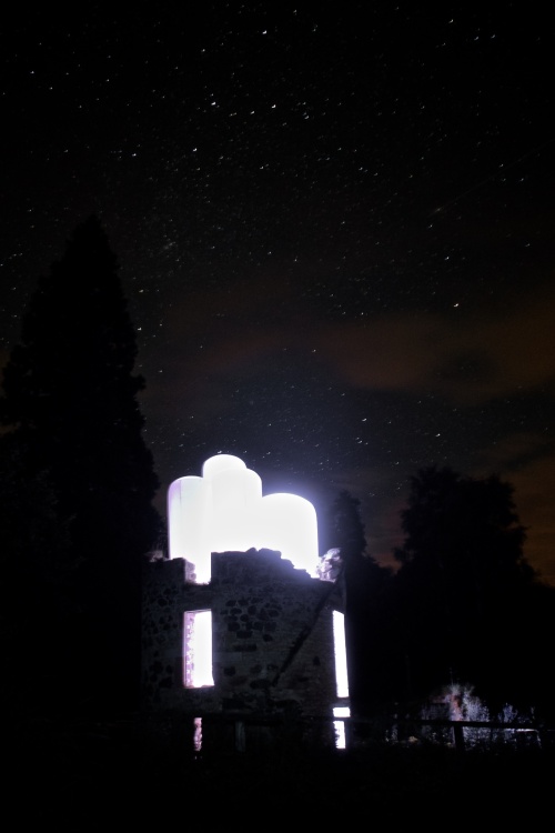
The Whistle here is situated on the top of the tower. Much of the tower survives from the 12th century, notably the stone spiral staircase up to the top bell chamber. The tower can no longer take the weight of swinging bells, so these are now static and rung by means of actuators on the hammers and controlled by a timer in the church.

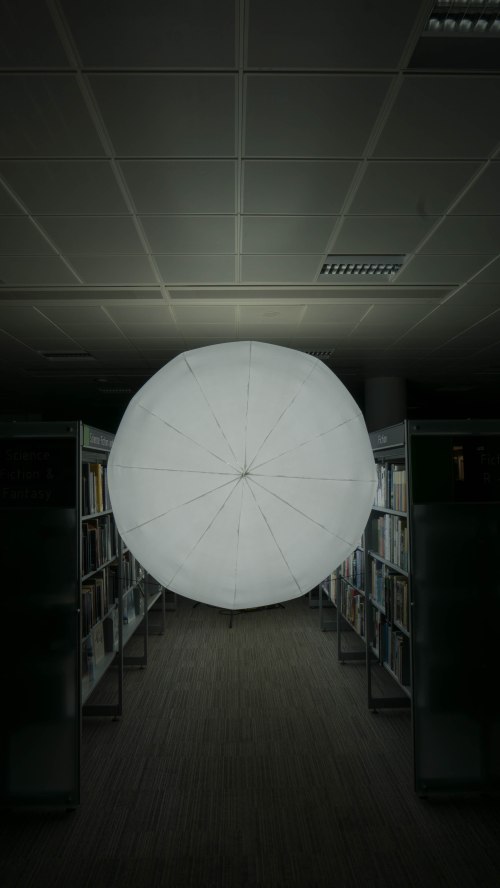
16. High Friars, Intu Eldon Square Shopping Centre

From St Andrews the wall crossed Newgate with a major gateway in the wall. Newgate was the largest structure in the wall and enlarged with a fortified barbican in the 1390. From there the line of the wall passes beneath what is now part of Eldon Square shopping centre. The original Eldon Square was an elegant formal square designed by John Dobson. This was controversially demolished in the 1970s to make way for the current shopping centre. The outside wall along the south side of Blackett Street follows the line of the town wall. Although there is no trace of the actual wall, its heritage lives on in the names of the quarters within the centre. The High Friars Mall follows the line of Friars Chare that ran through the nunnery gardens there. The opening space for the escalators beneath Eldon Leisure sits exactly on the site of Bertram Momboucher Tower and its square atrium space echoes the ghost of a tower. The original tower takes its name from Bertram Mombowcher – one of the high sheriffs of Northumbria during the reign of Edward III. This part of the town became the poorest area by the mid-19th century so atypical slum clearing fashion it was torn up and rebuilt as Blackett Street. The stones from the wall were reputedly reused to line the new sewers.

vert_angle_deg=0.2 / horiz_angle_deg=0.6

The current site of Bertram Momboucher Tower inside the shopping centre

The whistle inside the shopping centre is the closest to the public and as it’s in a relatively enclosed space has had to be specially engineered to be significantly quieter so as not to deafen shoppers. It’s still very loud though!

17. Monument entrance, Intu Eldon Square

the last whistle in the piece sits overlooking the statue of Earl Grey. The outside edge of the shopping centre sits directly over the site of Ficket Tower. The entrance to the centre follows the line of Friars Chare and the wall would have run alongside it next to the current Blackett Street. You can see the site of Ficket Tower in the distinctively rounded northern flank of the entrance. The whistle here is on the roof.

IMG_7725

The rounded end to the north face of the shopping centre echoes that of the Town Wall towers and Ficket Tower that once stood on the same spot 

From here the line of the wall runs along Blackett street, across Pilgrim Street on Pilgrim Gate and back to Carliol Tower. Pilgrim Gate was demolished in 1802 when the gate became too narrow for the wagons of the day. When it was demolished the builders discovered a 24 lb cannon ball in the walls – a remnant from the siege of 1644.

All in the piece runs around 2.2 miles (3.5 km) of the town wall. Of the sites there are three Grade II or II* listed, five Grade I listed, two scheduled ancient monuments, and part of a UNESCO World Heritage site. This is by far the most complicated piece I’ve done in terms of securing permissions – with over 20 landlords, tenants and licensing bodies to appease. The install documents alone run to nearly 200 pages.

But the complexity of the various locations and their individual connections with the history of the Town Wall, for me, adds so much more depth to the overall piece and cements the piece with the place in a way that simply wouldn’t work anywhere else.

Read Full Post »

Great Expectations

Snapseed 11.jpg

Last Friday we stood in the entrance of Newcastle’s majestic Central Station. Waiting. Looking up at the clock and list of departures. Watching the seconds tick by. Fairly normal activity for a station and we certainly didn’t seem out of place (apart from the observing TV camera crews). We we waiting for a sign. A signal. The starting gun. Only it definitely wasn’t a gun. This was a family friendly cultural event.

As the seconds ticked down – 40… 45 .. the anticipation grew. It was quite literally any second now. Then at 10 seconds to the hour the first pip sounded. A loud and confident sound from over in the concourse. Swiftly followed – within the same click of the seconds – by another, fractionally lower pitched peep. Then a third, more distant outside, across the road.

The next few seconds seemed to last minutes. The most pregnant of pauses. Then as the seconds, minutes and hours flicked over to 13:00:00 it arrived. The unmistakable blast of steam engine whistles. A dissonant chord, a cacophony of tone that filled the voids of the vast Station building, its great curving roof, its cavernous imposing portico, and bursting out the doors into the city beyond.

Elsewhere, another dozen whistles were bursting from rooftops – their ringing bouncing off the walls and windows of the city.

This is Whistle. This is the start of the Great Exhibition of the North.

The Great Exhibition of the North is an 80 day event spread over 50 venues across Newcastle and Gateshead, showcasing the best in art, design and innovation from the wider North of England. over recent years there’s been an increasing awareness of the ‘Londoncentricity’ that’s pervaded arts, culture, economy, media, politics. pretty much everything. The concept of the Northern Powerhouse was a way to devolve some decision making and profile to places north of London. The idea of a Great Exhibition of the North was launched by the government back in 2016 with northern towns and cities invited to tender as host for the event. In the end it went to a joint offer from Newcastle and Gateshead. There’s a lot of politics involved in the concept, decisions and role of the event, which apart from occasionally being a bit murky and occasionally insulting, is mostly unfortunate as at the core is actually quite a good thing and better off if you ignore the politics.

The nub of the idea stems from the Great Exhibition of 1851. This extravaganza, held in a vast contemporary glass and iron construction (later to become the Crystal Palace) was advertised as ‘The Great Exhibition of the Works of Industry of All Nations’ – although in reality it was to promote the industrial superiority of Victorian Britain. Businesses from across the world showcased exotic materials or used specially commissioned artworks to promote their place in a fast moving technological time. Over six million people visited the exhibition in London and the profits generated from ticket sales went to establish the Kensington Museums (the Science Museum, Natural History Museum and the V&A).

218551-1319804198

‘Opening Day of the Great Exhibition – 1st May 1851’ by David Roberts RA. image © The Royal Collection Trust

Great concept to recreate. Somewhere to show off all that the North of England contributes to the world. I envisioned all the major industries and hundreds of smaller and newer businesses showing the cutting edge of technology and innovation within the context of the historical powerhouse of invention and industry that is the North of England. We were promised water fountains the height of the Tyne Bridge, George Stephenson’s Rocket back in the North East, John Lennon’s last piano and the largest free event in the UK the summer.

opening

Having lived north of Preston for most of my life, I’m passionate about the area and the influence it has on my work, so naturally I wanted in.

I wanted to do something that looks at the industrial heritage of the North, celebrates Newcastle as a place and utilises current technology to link that ongoing narrative. despite it being in an urban environment I also wanted to say something about the landscape. It’s the landscape of the North of England that gives it identity and character and the reason it was the birthplace for so much technology and industry.

A few years ago I had done a pilot piece for a large-scale landscape installation using steam engine whistles in Loch Lomond and the Trossachs National Park. We’d done fair bit of research and development on that project to get to a point where it was possible and viable, but for a number of reasons had never been fully realised. The role of the North East as the birthplace of railways made it seem appropriate to revisit this piece.

There was a an open call for projects last year – something I don’t usually respond to – but I was taken by the whole idea of an exhibition for the North and it’s potential to realise ambitious projects so I put something in. The idea was for a mass of steam engine whistles to reverberate across Newcastle and the river once a day. The sounds echoing off the buildings and the river valley. Marking time and place – both the 1 o’clock in Newcastle, but also where we are in the 21st century in a digital world, with a reminder of how we got here. A fusion of past, preset and future in the spirit of that first Great Exhibition in 1851.

And so, standing in that 1850’s John Dobson designed train shed of glass and iron to hear those whistles from the age of steam ring out with split-second accuracy to open a new Great Exhibition, that spirit rose again.

Read Full Post »

Up until late last night, it was feeling like proper winter here in the Durham Dales. We’d had a nice covering of snow, which despite it forecast to disappear within hours, was topped up the following night giving us two days of prettiness. It wasn’t particularly deep – just an inch or two mostly. Not enough to cause any problems, but enough to coat everything around and transform it in the way only snow can.

IMG_6353.JPG

But it’s gone now. Washed away by ‘storm’ Dylan overnight. Now there’s no trace of it left – not even in the high gunnels on the fells. Our winter wonderland is just a memory – until the next time. Preserved only in the millions of pictures circulated on social media. The fast flicked repository for all the moments of all the people.

And now, on the last day of the year, 2017 is about to fall into the vault of past years. I seem to do a blog post of the year this time every year. It’s a good time to take stock, reflect and sometimes enjoy the moments that were far too hectic at the time.

As I reflect on all the things that happened that make up my experience of the past year, there are also the things that didn’t happen.

Lots didn’t happen in 2017.

Compas‘ was to be the centrepiece for my solo show at Mellerstain House in the Scottish Borders and the launch piece for the Borders Sculpture Park. A giant, double pointed form aligned with the lines of site and travel through the estate, the angles were drawn from the slope of the lawn while the dimensions – 60m long and 16m high – were the exact dimensions of the Robert Adam designed house.

compasright

It didn’t happen.

For a new arts festival in the Lake District, to celebrate its World Heritage Site status, I proposed a life-sized bouncy castle tower to go on the top of one of the lakeland fells. From a distance it would be a visual reference point on the horizon – the red standing out against the verdant landscape. For those venturing to the top of the fell, it would be a unique experience (and a lot of fun).

keep latrigg2

There are a lot of issues with commissioning bouncy castles. It’s a steep learning curve and one that ultimately proved too steep for far too many reasons. So it was changed to a solid nylon inflatable. Infinitely easier to handle and fabricate. However, the unpredictability of the weather on lakeland fells caught us out on the day and it didn’t happen.

Attempt to install Keep on Latrigg, September 2017. Photo © Helen Tuck

Attempt to install Keep on Latrigg, September 2017. Photo © Helen Tuck

Also not happening was a floating installation in a city centre location. This might still be subject to an NDA so I can’t say anymore.

droplets

But it didn’t happen.

I almost built the world’s largest freestanding paper arch in Vienna in the spring. Situated in a prime location amongst some incredible architecture and outside a UNESCO listed coffee house, the arch was built from standard copier paper with decorative colour accents reflecting the architecture of Otto Wagner. Standing 5m high at the apex, unlike my previous paper bridges, this didn’t spring off fixed abutments. Instead this was entirely free-standing. Just paper. Nothing else.

File 29-09-2017, 19 38 56.jpeg

But arches are complicated mathematical models and what seemed like such slight discrepancies in ground levels and the behaviour of lighter weight paper than previous bridges, despite all the scale modelling and calculations, it ultimately wasn’t stable enough to stand on its own.

It didn’t happen.

What did happen though was..

XXX – my first solo show at the newly launched Borders Sculpture Park at Mellerstain House. The ‘compas’ piece was replaced with ‘Scattered‘ – a series of large white spheres floating elegantly on the lake.

scattered panorama3.jpeg

These accompanied the more architectural ‘Pointed‘ and ‘Towered‘ pieces elsewhere in the gardens.

pointed v2.jpeg

toweredbynight.jpg

Keep was successfully installed on Castle Howe in Kendal, Cumbria, on the site of the first castle in the town. Its bright red contrasting with the ‘Auld Grey Town’ and a line of sight to the slightly newer castle ruin on the other side of the town.

DCIM/100MEDIA/DJI_0293.JPG

‘Keep’ from above Kendal Castle. Photo © Tony Watson 2017

Volume‘ was a photographic series of images of very temporary installations in the Newcastle City Library. The collection of images will form the basis of a very large scale bookwork that contemplates the space within the architecture of the building through the use of time and light.

L1120014.jpg

TreeBubble‘ was the last of the inflatable installations for the year. A 5m bubble wrapped around an ancient oak tree within the grounds of the Bowes Museum in County Durham.

L1120189-Edit.jpg

It was never an intention to do so many inflatable artworks in one year. Like so many things, it just seemed to happen that way. By contrast, so far none of the major pieces I’m currently working on for next year are inflatable, but that’s not to say i won’t return to them at some point in the future.

It’s certainly been an interesting year, with lots of challenges, lots of learning and lots of great people making all these things happen.

None of these things happen in isolation. There are so many people involved with each and every one of these project – bot the ones that happen as well as the ones that didn’t. It’s a long list but they all deserve my gratitude. So a huge THANK YOU to:


Susan & Franz Brunner, Mondi Group, Jon Stynes, Peter Foskett, Jane Haddington, George Binning, Jane Malloch, Sarah Coulson, Debbie Cunliff, Navigator North, Automated Cutting Services, Hendersons Textiles, SpaceCadets, Lisa Smith, Jen Morgan, ABC Inflatables, Four Colman Getty, Penny Anderson, Archifringe Festival, Lakes Alive Festival, Phillippa Haynes, Netty Miles, Tony Watson, Amanda Sutton, Rob Ives, Ian Horn, Helen Tuck, Jane Shaw, Andrew Scrogham, Mark Thurston, Gary Chapman, Points North, Phil Carr, UTASS, The Bowes Centre for Art, Design and Craft, Matthew Read, The Bowes Museum, Sarah Collicott, ProntaPrint Darlington, Artiq

and of course, everyone who comes here to read all the things I post. Comments always welcome, whether here or on all the other social media channels.

I’ve had a sneak peek at 2018, and it’s looking OK from here. So onward and upward. have a great New Year. See you on the other side.

Read Full Post »

It’s been so long since I last posted to this blog I’ve forgotten how to begin a new post. I know where I want to end up and part of the journey of getting there, but how to start is turning out trickier than it seemed.

Art is a bit like that. For me at least it’s largely instinctive. When students or journalists ask ‘where did the idea come from?’ I usually have some kind of answer to keep them happy. But the real answer is usually a lot more complicated and involved than that.

Ideas – inspiration if you like – is an ongoing process and one that probably started at birth. There are things you remember from various parts of your life that you recall or associate with places, sounds, smells, concepts, emotions. Sometimes they may feel quite random or spurious in their association at the time. But that’s just the way your brain works. To the extent that when someone inevitably asks ‘what’s the piece about?’ the answer is rarely straightforward either. In fact Ive recently decided to put a time scale on answering that. Three years minimum. That’s about as long as it takes to absorb the work and start to understand what it was really about.

Of course, art doesn’t have to be about anything at all. Francis Bacon was famously quoted as saying “The purpose of art is to deepen the mystery”.


Presence‘ – an album by Zed Zeppelin, has cover artwork featuring an obsessive hole. The nostalgic images from the 40s and 50s appear to show everyday people obsessed by an ever present mysterious void.

cover_2551922102016_r

Art directed by one of my heroes – Storm Thorgesson – the premise was to put an object from the future into the past. In true Thorgesson style rather than use archive images from the 40s and 50s, the cover images were shot for real on the basis that ‘nostalgia isn’t what it used to be’. There’s something unsettling about a familiar setting disrupted by something that is clearly not meant to be there. Yet in these images the ‘thing‘ appears not only to be accepted, but hold a real presence in all the situations. The irony being the ‘thing‘ is not even a ‘thing’ but a hole. The ‘presence’ is actually an ‘absence’. When the concept was first pitched to the band, Robert Plant’s response was “Who the hell needs to understand everything anyway?”.

The mysterious black object motif is also drawn in part to the monoliths in Kubrick’s film  version of ‘2001 – A Space Odyssey‘.

800full-20013a-a-space-odyssey-screenshot

In the film we see three large, black monoliths  – the first in prehistoric earth that appears to mark a turning point in evolution, the second one on the moon and the third orbiting Jupiter. The monoliths are a key marker in the plot of the movie – in many respects they are what the film is all about, yet they are also a source of endless discussion and conjecture about what they are. In Arthur C Clarke’s original books, the monoliths – and there are more than just those three – have a presence but no substance, only that their shape is in the proportion of 1:4:9 (the first three squared numbers). In the books it is also suggested they have dimensions beyond the physical three with ever increasing proportions (…16:25:36…). Of course their meaning and purpose could be very simple. They just are. What are they? – something else… where did they come from? – somewhere else… when did they appear?… they’ve always been there.

In short, they’re follies. Objects designed to be mostly there to just be there. I’ve written before about the Chinese tradition of placing man made objects in landscapes to make sense of the scale, form and colour of the vastness of their environment. As a kid I was always a little obsessed by the presence of follies. I remember seeing Horton Tower in Dorset and asking my grandparents  what it was for. “It’s just a tower. It’s not for anything” was their reply. Grandparents never lie. So it must have been true. Weird, maybe. But true.

Through my teens I learnt to appreciate the surreal-ness (is that a word?) of follies. The Belvedere Tower at Claremont Gardens was always tantalisingly behind gates, locked out of reach.

IMG_4730

‘Belvedere Tower’, Claremont Gardens, Surrey. A low-resolution scan from an infrared negative, but you get the gist…

There was always something Alice in Wonderland about its inaccessibility. Those clipped hedges framing the view up the lawn. It must have been a great view from the tower across the gardens and lake, only the windows aren’t real. They’re painted on. Part of Capability Brown’s masterpiece in landscape design. The tower was there for its presence. To look over the landscape, and while it obviously couldn’t actually look over the garden, it reinforced the idea that the landscaped garden was designed to be looked over. That looking was fundamental to what the garden was about.

Another favourite was Leith Hill Tower. A wonderful piece of gothic architecture built in 1765 to enhance the countryside. No more, no less. There’s stairs up to the roof which is (at just over 1000ft above sea-level) the highest point in southern England. However, the steps weren’t built until 100 years after the rest of the building. So for a century it was just a tower for tower’s sake.


This summer I built ‘Keep’ – a 10m high folly for the Lake District. OK, so I didn’t actually build it – Debbie in Manchester did the hard work with the sewing machine. Originally it was going to be a bouncy castle inside, but a number of design issues and some disastrous fabrication decisions put pay to that idea, so it was redesigned as just a folly. It was commissioned by the Lake District National Park as part of their Lakes Alive Festival. The original brief was around the theme of Cultural Landscapes to celebrate the UNESCO World Heritage Site listing for the Lake District. The English Lake District has it’s very own and important history in the world of landscape appreciation. Unlike most of the rest of England, Follies are not part of that tradition. However, I wanted to look at the role the Lakes played in the wider English Landscape Tradition and put a folly in that landscape.

keep latrigg2

Original mock-up of ‘Keep’ on Latrigg, above Keswick, Cumbria.

‘Keep’ was designed to be a very light touch in a protected environment. As an inflatable artwork it was easy to get onto site and install. It could be installed and taken down again the same day which meant in theory it could be taken to quite isolated spots and places where a more permanent folly would never be allowed.

However, as mostly made from air, it is very susceptible to weather conditions.  On the location I’d originally intended it to go – being around 2000ft above sea level and very exposed, the weather was prone to sudden changes. On the best day of the pre festival week, the conditions looked like they would be right to get the tower up for a few hours. However, during inflation the wind suddenly picked up to more than twice the safe maximum and the install had to be quickly abandoned.

Attempt to install Keep on Latrigg, September 2017. Photo © Helen Tuck

Attempt to install Keep on Latrigg, September 2017. Photo © Helen Tuck

The following weekend was the festival itself. Confined to Kendal, the piece was installed on Castle Howe – the site of the original castle in Kendal, but with a line of sight to the latter and existing castle ruin on the other side of the town. For a day the weather played ball and the piece did its job as being a tower.

Keep 004

For the Kendal installation, I chose Castle Howe partly so that there would be some kind of dialogue between ‘Keep’ in red and the existing castle in white – rather like rooks on a chessboard – maybe another Alice through the Looking-glass reference. It was also partly about the vibrance of the colour with the ‘Auld Grey Town’, as evidenced in Tony’s drone shots.

DCIM/100MEDIA/DJI_0293.JPG

Drone view from above Kendal Castle looking back to ‘Keep’ on Castle Howe. Photo © Tony Watson.

The install on a fell in the Lake District will happen at some point. I’ll keep a look out for the right conditions, both in terms of windspeed and in the colour and light quality of the surrounding landscape. When it’s right it’ll be stunning and ‘enhance the landscape’, whatever that means.

Two months on and I’m starting to understand what the piece is about. Having seen the piece working in Kendal, I’m getting a better idea what the piece is and how it works. It’s also something I’m keen to continue in the future. That may be taking ‘Keep’ out on the road for a series of installs, or it may be more involved than that. Who knows, maybe a whole series of follies in different landscapes.

More importantly, I’m happy not really understanding what the project means yet. All good art has at least ten different meanings. I’m quite sure using temporary follies to interrogate the landscape has at least that, but it may take me a while to discover what they all are.

There’s something about follies that seems to fit with the work I’ve been doing for the past few years.  I still don’t know what that something is, except it’s probably something else. But I do know it’s always been there.


Read Full Post »

I am already getting so behind in this tale. I set off weeks ago in all good faith half expecting to be at Barnard Castle by Easter. That hasn’t happened. While I’m more advanced in my journey than this blog would suggest – for those who follow me on social media will have seen I’m three bridges further on already – the annual awakening by people who want me to work with them has started and the day-to-day projects are almost at full capacity.

However, it’s a well-earned weekend off so I can pick up on where I was and start to clear the blog post backlog before I venture any further and make it worse.

In the previous post we’d got as far as Holwick Head footbridge. We’re now on very familiar turf. The next two stretches are very much my regular walking patch. It’s where I go most often when I need to get out to walk and think – or sometimes not think – frequently just as useful.

This is a well worn part of the Pennine Way and extremely popular with families at weekends. The while most set off from Bowlees to walk up past Low Force to High Force, a fair few will call it a day at Holwick Head, or head over the river to lunch at the High Force Hotel.

The river on this next stretch is always reasonably fast and it’s one of the steepest downhill stretches. Every hundred yards or so there is another little cataract or cascade helping it lose height. This stretch is also populated by a number of islands. When the river level is low, most of these are accessible from the south side. Some of the islands are barely separated from the bank, others are at points where the river splits and flows around them. The largest islands are separated by deep gullies which flow back up from the downstream end leading to a false sense of a very calm and flat river, when in reality on the far side of the island the river course is crashing down a series of violent falls with deep pools and jagged barricades of whinsill.

File 30-04-2017, 19 44 08.jpeg

On the day I walked to photograph it for this blog post the river was in full spate. A recent sharp thaw along with a day’s rain had really swollen the river and it was galloping along at a frightening pace. Leaping over every rock and boulder that still broke the raised water surface.

The largest of these cascades is Low Force. Here the river falls over a series of small drops before committing itself to the main 8m (24ft) fall.

File 30-04-2017, 19 42 48

Low Force is actually two main fall paths – the main one to the left is bisected by a stubborn  outcrop at the top dividing an otherwise continuous drop to a deep pool beneath. Only when the river is in spate does this fall take on the full grace of a seamless curtain or river. To the right another gap in the whinsill allows another deeper but narrower column of water to escape. The volume of water through this narrower opening makes for a much more powerful spout that frequently carries rainbows in its spray in the late afternoon. Further across the river is another of the occasionally isolated islands. This one is accessible from the north bank for most of the summer months and gives a great view of the falls from the other side of the river. In the winter months this island is separated by a shallower stretch of river which in turns cascades into a an elongated still pool just downstream of the main falls.

Today the falls were in full flow and Low Force was mostly one giant wall of water charging over the sill. The waters below were deep and dark and constantly swirling with a menace of unseen currents.

File 30-04-2017, 22 37 01.jpeg

Downstream of the falls a particularly impressive outcrop of the now familiar dolerite columns act as a perfect picnicking spot with classic romantic views of the waterfalls through the trees in the woods beyond.

Low force is a popular spot for visitors and locals alike. The accessibility of the waterfalls and myriad of revealed views give a very real impression of the power of the river at this point. Weekends see often large number of people coming to look in awe and wonder. A beauty spot I guess some would consider it.

File 30-04-2017, 19 17 07

Kayaking over Low Force on a sunnier day

Some get even more acquainted with the forces of nature. Most weekends in the spring and autumn when the water levels are up Low Force becomes a major attraction for kayakers, whitewater rafting or sometimes river rescue training. From Holwick Head footbridge to the sea at Redcar, the Tees is navigable all the way in a kayak. Only during extended periods of dry weather does the stretch down to Middleton in Teesdale become a problem when the rocky nature of the river bed and its dark water prove to be too difficult.

File 30-04-2017, 19 35 05

Just below Low Force the river is crossed by the first of the genuinely interesting bridges – Winch Bridge. Originally built in the 18th century to allow lead miners in Holwick village to get to the newer workings above Newbiggin the first bridge is thought to have been the earliest example of a suspension bridge in Europe. The original bridge was made from hand wrought iron chain links with a single handrail across. In 1802, during a bad storm, three people were crossing the bridge when it gave way and all three were plunged into the raging water beneath. Two were rescued but the third was swept away to his death.

File 30-04-2017, 19 21 14

The bridge was rebuilt in around 1830 and that is the form it takes today – two spans of cast iron chain with a timber walkway between. It has a handrail on each side suspended from cast iron towers on either side. Some additional strengthening was made in 1990, but it’s essentially the same 1830 suspension bridge and sways a fair bit when crossing.

File 30-04-2017, 19 20 19

It’s a good place for a bridge. The rock faces either side make the river narrow so a short crossing. The density of the whinsill make it a very stable base to anchor a bridge. With the river running so fast on this stretch, bridging the river was a much safer option than fording it. A suspension bridge is a really good design solution for this site, but I wonder, given that this was probably the first suspension or chain bridge in Europe how the miners arrived at this solution in the first place. Even this 1830’s rebuild is an elegant solution and one that’s clearly stood the test of time. With its footings well above the waterline, this is the bridge that so far has lasted the longest in the upper reaches of the river.

The steep chasm below and the dark, swirling waters add to the sense of drama of this bridge. That combination of foreboding rocks, black water and the height above them being crossed with something as light and delicate and a few plank of wood suspended between thin pillars that makes this a memorable crossing.

File 30-04-2017, 19 36 02

But there’s still another 50 miles or so to go before we reach the sea and there are many more ways that people have found to get across this river. From the centre of Winch Bridge you get a great perspective of the river turelessly working its way ever onward.

Read Full Post »

The curlews are back.

As a phrase it’s simple and short. You can pack so much into short phrases. In Shakespeare’s ‘King Lear’, the pivotal moment in the whole play is written as just ‘He died’. There’s no how or why or wherefore. No big announcement or speech. No high drama. Just two words.

The curlews are back.

it’s four words, granted, but in the upper reaches of the North Pennines it says so much. In any normal winter it would mark the end of it. A return to normal and the reassurance that everything will be OK again. With the numbers of curlew and lapwing and oystercatcher and redshank on the ever decline in the North of England, it marks something of a sigh of relief to hear those first whirring, bubbling, almost alien calls echoing around the fells.

Hearing those sounds also reminds me I’m in the Upper Dale, which is where I got to after leaving Cronkley Bridge. Heading ever onwards, downstream towards the distant sea.

Today the river level is up a bit and the water is running at a fair pace. Not quite in spate, but in a decided hurry nonetheless.

Following the Pennine Way, the path is well marked and maintained, but moves away from the course of the river as it swings right and left and right in big sweeping curves beneath Dime Holm Scar. Up on Bracken Rigg the path flatten out to a brief plateau and the gentle mounds of a bronze age settlement.

The path next meets the river just before the crushing plants of High Force Quarry loom up on the opposite bank. A still very active whinstone quarry, it’s a present reminder of the industrial activity that’s shaped all of the landscape around here. This now barren and wild landscape bears the marks everywhere of centuries of mining and quarrying and the wealth and poverty of those that came to make their fortune from what lies beneath the surface.

File 12-03-2017, 20 23 38.jpeg

But the landscape is vast too, and easily swallows up the industrial workings. A mere dot on the wider view.


And opposite, barely visited and overlooked by the rumble of machines and steel and rubber tyres, is one of the most spectacular waterfalls in this part of the Pennines.

File 12-03-2017, 20 45 09.jpeg

Bleabeck Force is the final leap where two becks from way up the fell meet and tumble down in a race to get to the river. From the Tees there is a small concrete beam bridge that gives you a view up the lower cascades and the top of the highest one. A short scramble over the boulders rewards you with a great view of the main fall and plunge pool below. The water levels on these fellside becks and gills are fickle and I’ve walked past this many times and never seen it look quite so spectacular. I’ll definitely make the journey up on a spate day.

File 12-03-2017, 19 24 42

Back at the Tees, the river is still in a bit of a hurry. Skipping over the rocky bed which itself is becoming increasingly jarred and jagged with much larger outcrops appearing to grow up from the river bed. These angular intrusions breaking up the flow of the river and churning it white and chaotic.

File 12-03-2017, 19 47 13.jpeg

A quarter of a mile further on the river meets a wall of whinstone and is forced into a narrow channel down one side. The full width of the river – maybe 10 metres or more squeezed into a gap no more than a metre in places. here the water shows it’s true potential. You sense it’s speed and sheer will power.

File 12-03-2017, 20 24 57.jpeg

It’s sprinting now.

File 12-03-2017, 19 34 34

Then with one last twist and pirouette it leaps.

File 12-03-2017, 19 32 32

and over a 35m vertical drop. In one, two steps.

As it collides with the pool below, large quantities launch back up against the incessant downforce.

This is High Force. The ‘biggest’ waterfall in England. I’m not sure how they quantify these things. It’s not the highest or the widest, but when in full flow it certainly has the largest volume of water per metre drop. Or something like that. Well, it’s impressive and it’s the biggest tourist attraction in the upper dale.

There’s two ways to see this. From the carpark beside the High Force Hotel on the main dale road there’s a very attractive path that leads down the steep gorge to the base of the water falls for a few pounds entrance. Here you get to be as close as you’d want to get o experience the full power of the falls. When it’s in full flow the spray can be so much it’s difficult to see the falls. But the sight of that much water in full motion and the continuous roar is a real experience.

Alternatively, from the Pennine Way on the other side of the river, you can get scarily close to the very top of the falls and watch the water disappearing down to the river below. Further downstream, there’s a little path off the main route that takes you to a small, unmarked viewing clearing where you get to see the whole waterfall in it’s full glory. And this one is free.

File 12-03-2017, 19 31 16

Breaking yourself away from watching the waterfall, the path continues through a very ancient juniper forest while the river runs through a steep wooded gorge below and largely unseen for about a mile. The path meets the river again at the next bridge.

File 12-03-2017, 19 23 42

It’s bridges we’ve really come to see and this is a fine one. Holwick Head Footbridge links the main Teesdale road with Holwick Head House and the track down towards Holwick village and the Earl of Strathmore’s estates.

File 12-03-2017, 19 28 44

Upper Teesdale is split into two major estates – to the north is the Raby estate of Raby Castle and the ownership of the Lord Barnard. It can be distinguished by its whitewashed buildings and dark blue paintwork. To the south of the river at this point is the estate of the Earl of Strathmore who has a country house at Holwick Lodge. Holwick Head Bridge marks a link between the two estates and was originally built by the then Duke of Cleveland in 1896 and was known at the time as the Duke’s Bridge.

File 12-03-2017, 19 29 31

It was rebuilt as a single footbridge by Durham County Council in 1998, but still retains the rather grand cast iron gateposts of the original bridge made by Motley and Green of Leeds.

File 12-03-2017, 20 26 21

It’s a simple steel girder construction over a central stone pillar with wooden decking. It’s a popular bridge with walkers making circular trips along the river, or just as a stopping place to stand and watch the river run below. But its still only a footbridge. The first proper road bridge across isn’t for another six or seven miles yet which makes you realise just how isolated the south side of the river is. These bridges may be few and far between, but they’re vital for getting around this landscape.

File 12-03-2017, 19 30 21

From the top of the bridge the river is busy on its way and largely ignores the passing of people overhead. It may have lost some of its width since High Force, but it’s lost none of its sense of purpose. There’s no slowing down or pausing to catch a breath. It will need all its energy to get past the next bit.


Read Full Post »

Bridge numbers. I like bridge numbers. Bridges that cross canals and railways (and motorways for that matter) all have numbers. Names are good, but numbers give you a sense of where you are. On canals they are an essential navigation aid. But bridges over rivers don’t need numbers. The difference between things you go over as opposed to things you go under I guess. Still, I’m counting these bridges over the Tees. Cow Green Dam Wall isn’t technically a bridge, so Birkdale Bridge is no.2. It’s a litle way to no.3.

We left the river below Birkdale Bridge as it plummeted down Cauldron Snout. This cascade is more a series of cataracts over a 180m length – making this the longest waterfall in England. There’s a good clamber down the entire south side over the dolerite pillars of winsill so plenty of places to admire the power of the water as it plummets down a total of 60m. Even on relatively dry days, as the water is regulated at the dam it’s always an impressive sight.

cauldron snout brdge.jpg

There used to be a little wooden footbridge across the falls – about halfway down.  This would have given an incredible view of the torrents below. Before the reservoir was built, the river ran round a long sweeping crescent picking up speed so by the time it reached the top of Cauldron Snout it was already wild and raring to go. The wooden bridge disappears from the maps by the 1940s and a track bridge appears about where the dam wall is today. But never both together. The amazing moving bridge. There’s more of these to come further downstream..

At the base of the falls, the river meets with Maise Beck – one of its larger tributaries at this end and corners beneath the cliffs of Falcon Clints. This next section along the shadow of Cronkley Fell is wide and flat. The river here is very wide given how young it still is. It’s very shallow but very fast. From here to the top of the next waterfall, High Force – about 6 miles away – it’s got 100m to fall so it’s on a bit of a sprint while it can. The landscape here is classic glacial pasture. big wide and relatively flat land with steeply rising fells beyond. Thousands of years ago this valley was scoured out by the receding ice flows. Long before that, these carboniferous rocks stretched across to the much older Lake District and formed a border with the still separate Scotland. It’s a very old landscape indeed.

file-04-02-2017-16-56-57


As the land flattens out, so the farms start to appear. First up on the left is Widdybank Farm. As remote hill farms go, this is particularly remote.Yet along the banks of the river the pasture area is flat and fertile. Great for cattle, but still too exposed and high up to grow anything meaningful.

file-05-02-2017-12-28-44

There are no bridges for miles, but the river is wide and shallow and during the summer months certainly fordable at any number of points.

File 05-02-2017, 12 47 26.jpeg

Further along on the north bank are the remains of a pencil mill. Here the sedimentary rocks were ground down and  pressed into moulds to make pencils. The mill opened in the mid 19th Century and produced pencils – know locally as ‘widdies’ until 1890.

The river winds and widens until near the far end of Cronkley Fell we find Cronkley Bridge. Bridge no.3 in my book. This is a simple steel girder span over two intermediate stone pillars with a wooden deck. It’s flat and utilitarian and is probably 1950s. The main feature is its length – about 40m. We won’t see another longer bridge for over 30miles. You would normally build a bridge at its narrowest point. It’s certainly the cheapest way to build one. I imagine, as the river is shallow and with a flat rocky bed, this would be an ideal fording point, but a bridge has been marked here on maps certainly from the mid 1800s.

file-04-02-2017-16-55-13

I had planned on following the river towards High Force about a mile downstream, but a loose and very vocal dog at one of the farms clearly had other ideas, so that bit is another for a revisit. Cronkley Bridge is on the Pennine Way so it’ll be a bit busier later in the year. Also, from March the wading birds return to nest on these high moors. Today it’s almost silent, but by mid April the air here is filled with the strange whoops and warbles of Curlew and Lapwings, the buzz of snipe and the cackle of grouse – over 3/4 of England’s native Back Grouse live in these barren hills of the North Pennines.

But that’s bridge no.3 done. The next four are all walking distance from where I live so familiar territory for a bit…

Read Full Post »

Maybe it’s that new year thing when you start out with good intentions – bold ideas, long-term plans, fresh start or whatever, but I guess every new thing has to start somewhere, at sometime. It seems that the winter months are when I look ahead to the coming year and finally get to start working on new projects. There’s still some gaps in the overall view of the year, but from what’s already there I’m getting a feel for the overarching themes. While last year was more about textures and moments, this year looks like being one of spaces and voids. Strange how things find their own threads.

Last year I really got to know some of the river where I live. I spent large chunks of time watching it, filming it, photographing it, editing the results and creating the major piece of the year – ‘Waterfall‘. I’ll probably do a more in-depth post about that at some point, but for those new to the game, ‘Waterfall’ saw three white-washed field barns wrapped in slow-motion film footage of the three main waterfalls of the River Tees. Each barn became a visual cube of slow moving water in the night sky. It was big and awesome and probably the best thing I’d done in a long long time.

Since that piece I’ve had an uncomfortable relationship with the river. I used to go down there almost every day, but the daily photographing and research has probably made me over familiar now and some of its magic is somehow lost. I kind of know how it does all its tricks now.

So I needed to find a way to re-engage with the river. There are new things I need to discover. I need to find another story in it.

Then last week I caught up with Andy Carters ‘270’ project on his Calling All Station YouTube channel. Over the next 52 weeks Andy  is aiming to visit all 270 stations on the London Underground. To make it more interesting he has to pass through the ticket barriers at least once at every station – either coming or going through them, not just passing through on a train. It’s this slowing down of the travel that makes you stop, look, think and examine the familiar. About 40 stations in (starting with the boring bits of the  Jubilee Line) and I’m already hooked. Each station is documented on his blog as he goes along too, creating a comprehensive gazetteer of architectural gems and subterranean secrets beneath the capital.

Inspired by his journey, I’ve decided on mine – to visit and cross* every crossing of the River Tees from source to sea.

Bridges are fascinating things. I’ve had my own experiences in constructing them. Essentially they are practical engineering – a way of traversing in this case water. Yet as purely man made structures in what is on this route, mostly open countryside, they have a very distinctive presence within the landscape to manage.

Today I made a start. The purist in me wanted to start at the source and work progressively downstream. However, it’s still very much winter and as the Tees starts just below the summit of Cross Fell – the highest peak on the Pennines – and very much buried under snow for the next few weeks I’ve decided to scrap that and not be precious about the order in which I visit the bridges.

My first crossing then wasn’t even a bridge. It was also one of the biggest structures on the river – the dam wall at Cow Green Reservoir.

file-30-01-2017-17-02-50

Between 1969 and 1971, a section of the Upper Tees was flooded to create the 2-mile long Cow Green Reservoir as a part of of a series of interventions to regulate the flow of water down the river for abstraction purposes. The 1/4 mile long concrete reinforced embankment holds back 40,000,000,000 litres of water (count those zeros!) while the entire river flow is regulated by sluices on the southern bank. So technically the River Tees flows beneath it, so the dam wall is a crossing.

file-30-01-2017-17-07-48file-30-01-2017-17-03-33

The reservoir sits in a natural basin of pasture land high in the North Pennines. The landscape here is a unique blend of very specific geology and rare botanical habitat. Widdybank Fell which sits along the Durham side of the water is home to the rare Blue Gentian  and the only place in the UK where alpine plants have survived since the last great ice age. The land here is fertile and remains of bronze age summer farms lie beneath the reservoir – themselves an indicator of how climate changes over time. Back then temperatures in these upper fells were around three degrees warmer. It might not sound much but the weather here is now too cold for most wading birds to breed on the reservoir. On a fairly bright day like today it felt relatively mild a few miles downstream, yet up here the shaded bays on the water are still iced over and pockets of snow lie in the heather.

file-30-01-2017-17-01-52

Today the reservoir sits in the Moorhouse National Nature Reserve – the largest nature reserve in the UK taking in the highest fells in the Pennine chain and the upper catchments of the River Tees.

The wall is an immense brutal slab of industrial infrastructure. Its scale and construction means it’s never going to blend in (whatever that means) and makes a bold statement within the landscape. Yet, the sparsity and relative bleakness of this part of the dale tolerates its monolithic brutality. The scale of the landscape seems to just swallow it up. As the river rushes quickly away from the wall thinly over bedrock, there is a greyness and roughness, that is almost alien in spirit and the concrete meets the bedrock as an ancient ancestor and the family resemblance is still there.

Within yards of the wall, the river passes beneath Birkdale Footbridge. This is the first of the bridges in County Durham and is still a border crossing between Durham and Cumbria. Built in 1966 – and just predating the dam wall – it’s made from a concrete span sitting on two reinforced stone pillars in the river. Like the dam, it’s a very utilitarian structure and supports a private access road and the Pennine way.

Downstream of the bridge the river disappears down a series of dramatic cataracts between basaltic columns of winsill. At a total of over 200ft, Cauldron Snout is one of the main waterfalls of the River Tees and shows how fast the water develops its wild character from the man-made sluices of the reservoir.

file-30-01-2017-17-21-18

So this is where my journey this year begins. I’ll back track when it’s warmer to find the source of the river and the only bridge beyond the reservoir, but I’m looking forward to discovering the journey of the water from the sluices as it cuts its way through the landscape towards the sea, and how people have built ways of traversing it.

It’s a long a winding story and I’m looking forward to discovering the stories and narratives of those crossing places. it’s a rich history and along the way I’m going to find Romans and Saxons, and JMW Turner and Lewis Carroll and railways and steel and plutonium. Lots of landscape and lots of engineering. And lots of walking.


*ok. so I won’t walk over the railway bridges,or motorway one and will probably give the pipe bridges a miss too

Read Full Post »

Success. It’s a great concept, but what do you mean by success? Sure fast cars, big houses and pots of cash can be a fair indicator, but success can exist at all levels – like when your Yorkshire puddings rise evenly or when you put a piece of IKEA furniture together and you don’t have any pieces left over.

But what about art? When would you consider yourself a successful artist, or even how do you measure the success in an artwork? These are the kind of things you have to evaluate for funding reports and consultations. Stuff I don’t like doing and generally try to avoid, mostly because it’s full of questions like this.

Sure, last year’s PaperBridge in the Lake District seemed to be a success. It went up and stayed up. It even went down well with visitors attracting nearly 10 times what I’d anticipated. Pictures of it went around the world and it appeared on TV on four continents. That’s pretty successful isn’t it?

IMG_5796 - Version 2

‘PaperBridge’ in BBC Focus magazine

Well, if being popular with the general public is the measure of success then yes. But as a work of art, how do we measure success for that? Did it do all the things art needs to do? I’m not sure how we work that out. I’m quite sure it didn’t fail though. That’s a different thing.

One recent TV interview asked me about risks involved in putting up a bridge made of paper. In particular they wanted to know how sure I was that the one in China would take a car going over it. The honest answer to that was I wasn’t sure. It had never been done before at that scale so how would anyone know? In fact there was a very real risk that it wouldn’t work. It could so easily have failed and collapsed and trashed a £100k car. Sure we  took lots of precautions and did lots of complicated calculations. We even enrolled a world leading structural engineers to check it all over with the latest hi-tech computer modelling. But at the end of the day they had to admit there were too many unknowns involved in building big structures out of sheets of paper – a material not made for building bridges out of – to sign it off as safe. In short – no one knew for sure it was going to work.

On one level the risk-taking was part of the deal. That element of peril was part of the narrative. If it was easy it wouldn’t have been as big a deal. If it was easy someone else would have done it before, I’m sure.  Actually, as I’d built a bridge before I kind of knew how they behaved and was sure it’d be fine, so I probably over did the risk bit for dramatic effect – but I certainly didn’t tell the client.

What was important was that everyone involved was aware of the risk and was happy to take that risk with me.

IMG_4287 - Version 2

RangeRover on ‘PaperBridgeChina’. Suzhou, November 2015

There’s a real element of risk in all my projects. Someone once said to me – if you have a 100% success rate, you’re not taking enough risks. When you’re pushing at the boundaries of things, that’s where the excitement comes in and if you manage to pull it off then that’s where great things can happen.

In that respect, the opposite to risk and success is mediocrity. There’s nothing more dangerous than playing it safe. Taking the easy road. That’s where things get stuck or become so half baked they start to deteriorate into something much much worse.

File 19-04-2016, 20 23 54.png

Mediocrity in all its splendour. This ad screen in Newcastle is sturdy, health and safety compliant, practical and meets all the planning regulations. What’s not to like? errr…. (image © James Perry via twitter)

Failure on the other hand isn’t so bad. Every now and then I have a project fail in me. More often then not it’s at such an early stage no one ever knows. I’ve lost track of the number of times projects I’ve been asked to get involved with have failed at the proposal stage. Some don’t even get that far. Mostly these are because the client doesn’t want to take a chance. Play it safe maybe. In which case, they’re just not the people I want to work with. Occasionally a project will get all the way to the final piece and then fail in spectacular style. That’s a different issue. I once had a high profile piece that was supposed to be up for 5 months, however it blew away after 5 days. Still, it went in if only for a short while, and even led to a chapter in a large international publication about just why it failed – the reasons were really interesting. I’m not sure the client saw it that way mind.

And then there’s the times that failures aren’t really failures. ‘Metropolis’ – the fritz Lang cinematic masterpiece. The first film with a final budget in the millions. It was only ever shown at one cinema before being deemed a flop by the studio. It was subsequently re-edited to a shorter story in an attempt to reclaim the costs.

metroufa4

photo: Alex Stocker (1896 – 1962) – Ufa-Pavilion, Berlin. 1927


Schubert never heard any of his symphonies performed. Very little of his orchestral music was performed at all during his lifetime, yet his ‘Unfinished’ symphony is now regarded as one of the greats of its time.

More recently, Anish Kapoor’s ‘Orbit’ became the victim of a playing it safe mentality with the producers and suffered from an incursion of mediocrity that has now extended to installing a helterskelter slide down it. I think time is yet to decide on that piece.

IMG_3541 - Version 2

‘Orbit’ by Anish Kapoor at the Olympic Park, London. 2012

If I’m being brutally honest, I think there are problems with most of my pieces. There’s always something that doesn’t go to plan or work out quite how I wanted it. However, in most cases these are things other people generally don’t notice. Or I make a feature of them. That line between success and failure is so fine. So delicate in fact it’s barely there. Or at least not so you’d notice.


post script.

Since writing this bog post (sitting outside in the sun with a cup of tea) I’ve just stumbled across this wonderful book on failure by Erik Kessels. He does it so much better than me. Not sure why I bother sometimes…

Read Full Post »

Older Posts »